An Efficient Target Detection and Recognition Method in Aerial Remote-sensing Images Based on Multiangle Regions-of-Interest
Publication
Metrics
AI Quick Summary
This paper proposes an efficient target detection and recognition method for aerial remote-sensing images using a deep convolutional neural network combined with a region proposal network to generate multiangle regions-of-interest, achieving more accurate and precise results compared to traditional methods. The method shows significant potential for remote-sensing image recognition.
Paper Preview
Abstract
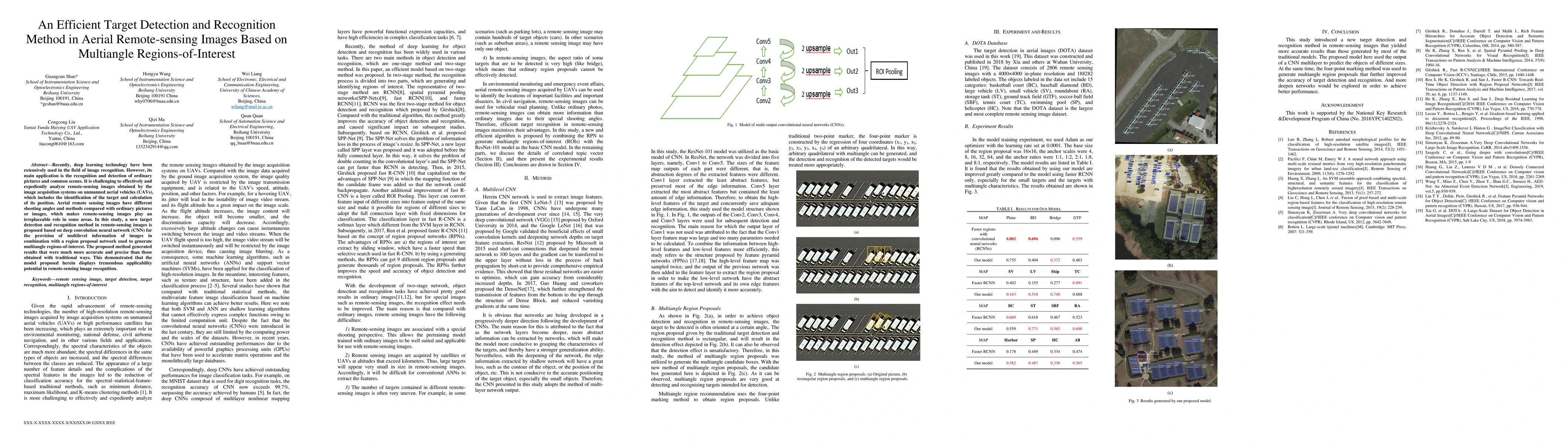
Recently, deep learning technology have been extensively used in the field of image recognition. However, its main application is the recognition and detection of ordinary pictures and common scenes. It is challenging to effectively and expediently analyze remote-sensing images obtained by the image acquisition systems on unmanned aerial vehicles (UAVs), which includes the identification of the target and calculation of its position. Aerial remote sensing images have different shooting angles and methods compared with ordinary pictures or images, which makes remote-sensing images play an irreplaceable role in some areas. In this study, a new target detection and recognition method in remote-sensing images is proposed based on deep convolution neural network (CNN) for the provision of multilevel information of images in combination with a region proposal network used to generate multiangle regions-of-interest. The proposed method generated results that were much more accurate and precise than those obtained with traditional ways. This demonstrated that the model proposed herein displays tremendous applicability potential in remote-sensing image recognition.
AI Key Findings
Get AI-generated insights about this paper's methodology, results, significance, and more — seven facets brought into focus.
Impact
Paper Details
Authors
PDF Preview
Key Terms
Citation Network
Current paper (gray), citations (green), references (blue)
Display is limited for performance on very large graphs.
Discussion 0