An infectious diseases hazard map for India based on mobility and transportation networks
Publication
Metrics
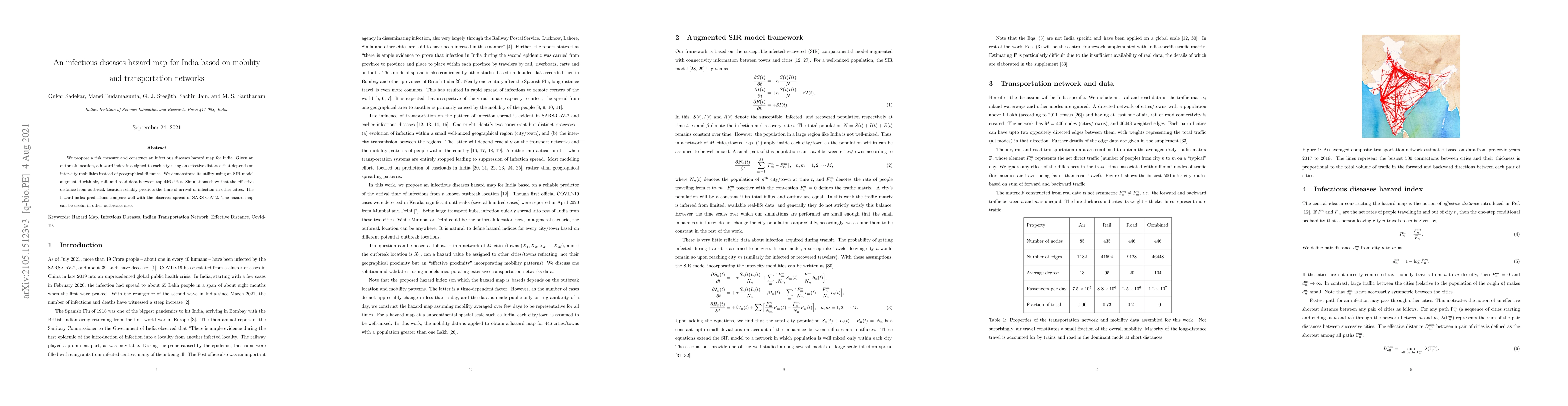
AI Quick Summary
The map uses effective distances instead of geographical distances and demonstrates its utility with a SARS-CoV-2 model, showing reliable predictions of infection arrival times in other cities.
Paper Preview
Abstract
We propose a risk measure and construct an infectious diseases hazard map for India. Given an outbreak location, a hazard index is assigned to each city using an effective distance that depends on inter-city mobilities instead of geographical distance. We demonstrate its utility using an SIR model augmented with air, rail, and road data between top 446 cities. Simulations show that the effective distance from outbreak location reliably predicts the time of arrival of infection in other cities. The hazard index predictions compare well with the observed spread of SARS-CoV-2. The hazard map can be useful in other outbreaks also.
AI Key Findings
Get AI-generated insights about this paper's methodology, results, significance, and more — seven facets brought into focus.
Impact
Paper Details
Authors
PDF Preview
Key Terms
Citation Network
Current paper (gray), citations (green), references (blue)
Display is limited for performance on very large graphs.
Discussion 0