An Open-source Tool for Hyperspectral Image Augmentation in Tensorflow
Publication
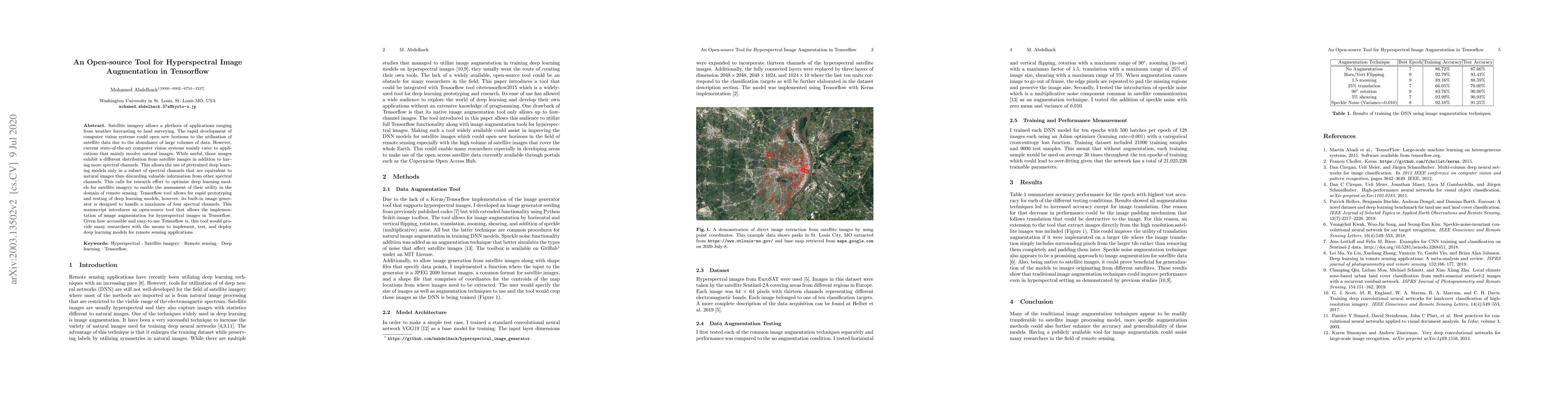
Metrics
AI Quick Summary
This paper introduces an open-source Tensorflow tool for augmenting hyperspectral images, addressing the limitation of the built-in image generator that handles only up to four spectral channels. It aims to facilitate the development and testing of deep learning models for remote sensing applications.
Paper Preview
Abstract
Satellite imagery allows a plethora of applications ranging from weather forecasting to land surveying. The rapid development of computer vision systems could open new horizons to the utilization of satellite data due to the abundance of large volumes of data. However, current state-of-the-art computer vision systems mainly cater to applications that mainly involve natural images. While useful, those images exhibit a different distribution from satellite images in addition to having more spectral channels. This allows the use of pretrained deep learning models only in a subset of spectral channels that are equivalent to natural images thus discarding valuable information from other spectral channels. This calls for research effort to optimize deep learning models for satellite imagery to enable the assessment of their utility in the domain of remote sensing. Tensorflow tool allows for rapid prototyping and testing of deep learning models, however, its built-in image generator is designed to handle a maximum of four spectral channels. This manuscript introduces an open-source tool that allows the implementation of image augmentation for hyperspectral images in Tensorflow. Given how accessible and easy-to-use Tensorflow is, this tool would provide many researchers with the means to implement, test, and deploy deep learning models for remote sensing applications.
AI Key Findings
Get AI-generated insights about this paper's methodology, results, significance, and more — seven facets brought into focus.
Impact
Paper Details
Authors
PDF Preview
Key Terms
Citation Network
Current paper (gray), citations (green), references (blue)
Display is limited for performance on very large graphs.
Discussion 0