Summary
We present an open source toolkit of flight-proven electronic devices which can be used to track, terminate and recover high altitude balloon flights and payloads. Comprising a beacon, pyrotechnic and non-pyrotechnic cut-down devices plus associated software, the toolkit can be used to: (i) track the location of a flight via Iridium satellite communication; (ii) release lift and/or float balloons manually or at pre-defined altitudes; (iii) locate the payload after descent. The size and mass of the toolkit make it suitable for use on weather or sounding balloon flights. We describe the technology readiness level of the toolkit, based on over 20 successful flights to altitudes of typically 32,000 m.
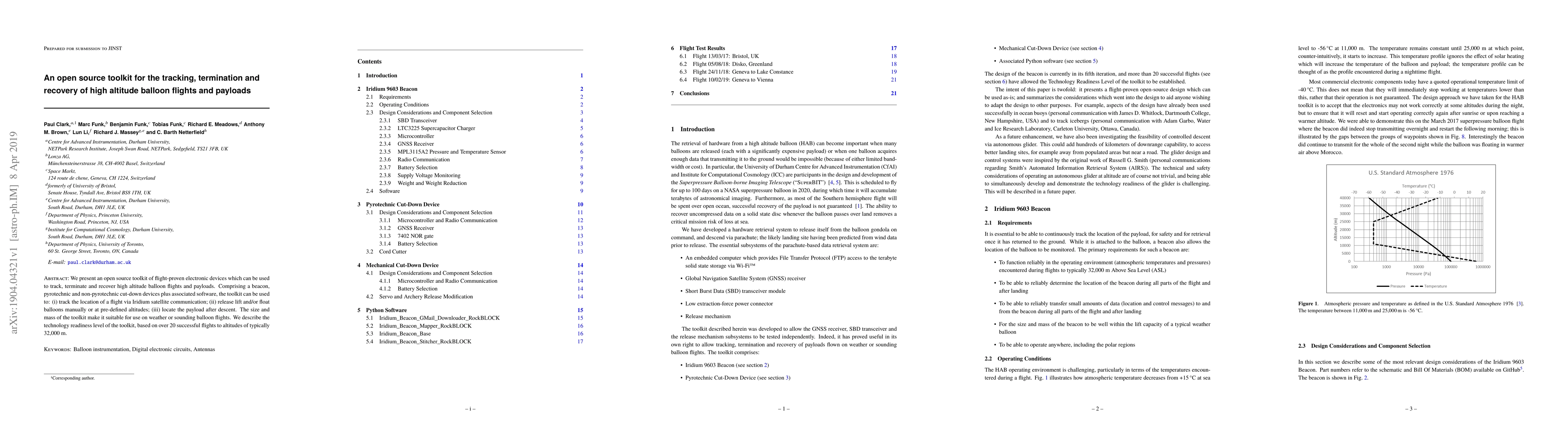
AI Key Findings
Get AI-generated insights about this paper's methodology, results, and significance.
Paper Details
PDF Preview
Key Terms
Citation Network
Current paper (gray), citations (green), references (blue)
Display is limited for performance on very large graphs.
Similar Papers
Found 4 papersOpen-VICO: An Open-Source Gazebo Toolkit for Vision-based Skeleton Tracking in Human-Robot Collaboration
Elena De Momi, Arash Ajoudani, Juan M. Gandarias et al.
GR-NLP-TOOLKIT: An Open-Source NLP Toolkit for Modern Greek
John Pavlopoulos, Ion Androutsopoulos, Lefteris Loukas et al.
| Title | Authors | Year | Actions |
|---|
Comments (0)