Applying multi-angled parallelism to Spanish topographical maps
Publication
Metrics
AI Quick Summary
This paper presents an overview of Multi-Angled Parallelism (MAP) for line recognition in binary images and adapts it to analyze lines in Spanish topographical maps, aiming to test the method's effectiveness and explore its customization for specific applications.
Paper Preview
Abstract
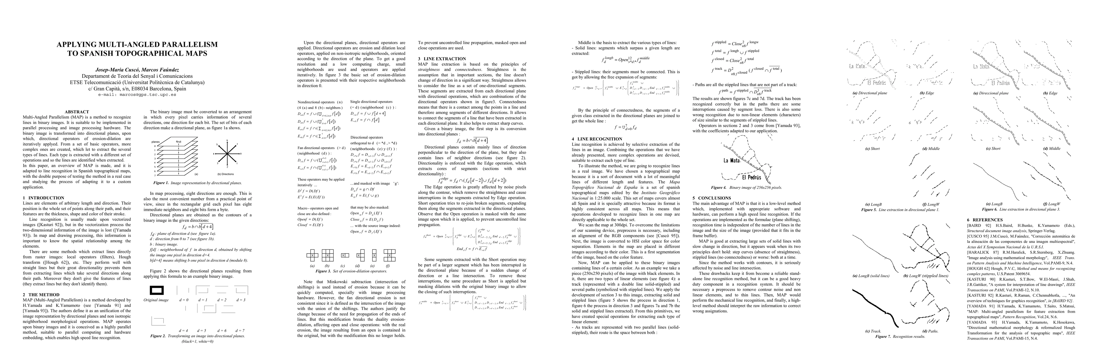
Multi-Angled Parallelism (MAP) is a method to recognize lines in binary images. It is suitable to be implemented in parallel processing and image processing hardware. The binary image is transformed into directional planes, upon which, directional operators of erosion-dilation are iteratively applyed. From a set of basic operators, more complex ones are created, which let to extract the several types of lines. Each type is extracted with a different set of operations and so the lines are identified when extracted. In this paper, an overview of MAP is made, and it is adapted to line recognition in Spanish topographical maps, with the double purpose of testing the method in a real case and studying the process of adapting it to a custom application.
AI Key Findings
Get AI-generated insights about this paper's methodology, results, significance, and more — seven facets brought into focus.
Impact
Paper Details
Authors
PDF Preview
Key Terms
Citation Network
Current paper (gray), citations (green), references (blue)
Display is limited for performance on very large graphs.
Discussion 0