Applying multiple testing procedures to detect change in East African vegetation
Publication
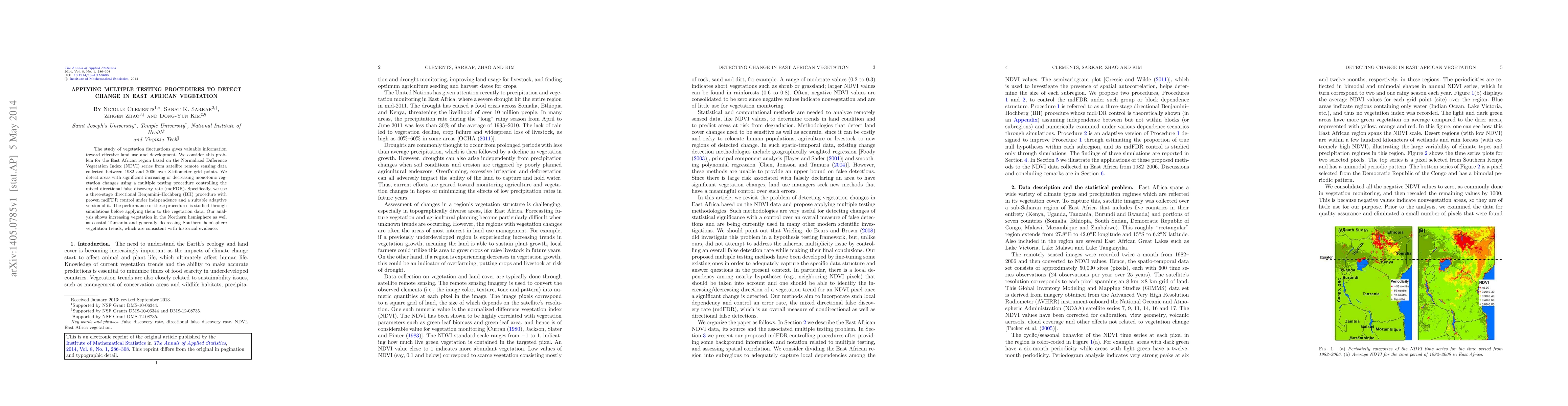
Metrics
Paper Preview
Abstract
The study of vegetation fluctuations gives valuable information toward effective land use and development. We consider this problem for the East African region based on the Normalized Difference Vegetation Index (NDVI) series from satellite remote sensing data collected between 1982 and 2006 over 8-kilometer grid points. We detect areas with significant increasing or decreasing monotonic vegetation changes using a multiple testing procedure controlling the mixed directional false discovery rate (mdFDR). Specifically, we use a three-stage directional Benjamini--Hochberg (BH) procedure with proven mdFDR control under independence and a suitable adaptive version of it. The performance of these procedures is studied through simulations before applying them to the vegetation data. Our analysis shows increasing vegetation in the Northern hemisphere as well as coastal Tanzania and generally decreasing Southern hemisphere vegetation trends, which are consistent with historical evidence.
AI Key Findings
Get AI-generated insights about this paper's methodology, results, significance, and more — seven facets brought into focus.
Impact
Paper Details
PDF Preview
Key Terms
Citation Network
Current paper (gray), citations (green), references (blue)
Display is limited for performance on very large graphs.
Discussion 0