Approximate Bayesian inference for multivariate point pattern analysis in disease mapping
Publication
Metrics
AI Quick Summary
This paper introduces a Bayesian inference method for analyzing multivariate case-control georeferenced data in disease mapping, employing a log-Gaussian Cox process to model spatial distributions of different cancers. The approach accounts for risk factors like pollution exposure and identifies high-risk areas using integrated nested Laplace approximation (INLA).
Paper Preview
Abstract
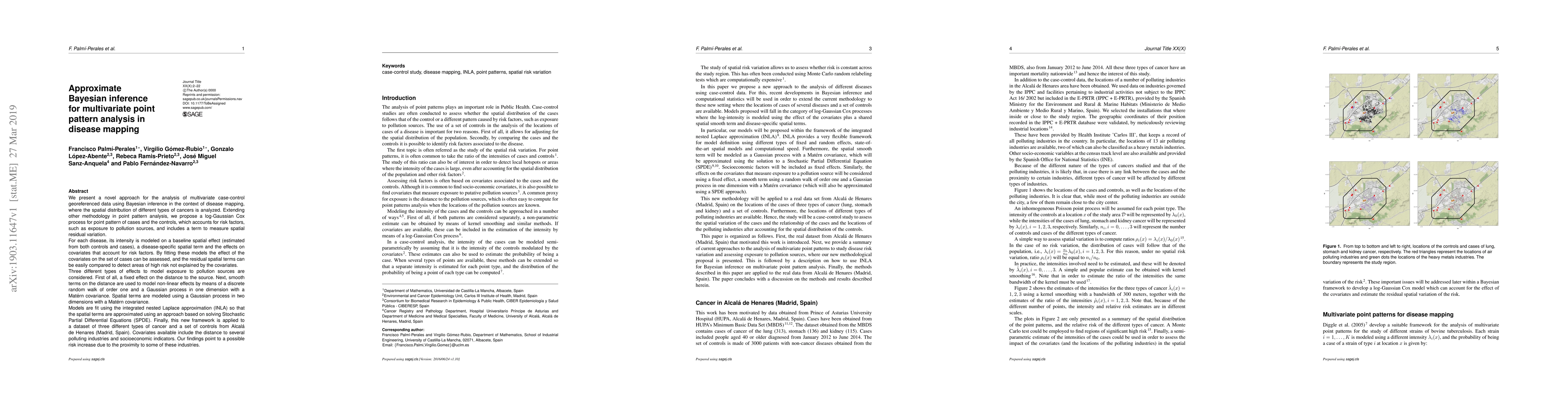
We present a novel approach for the analysis of multivariate case-control georeferenced data using Bayesian inference in the context of disease mapping, where the spatial distribution of different types of cancers is analyzed. Extending other methodology in point pattern analysis, we propose a log-Gaussian Cox process for point pattern of cases and the controls, which accounts for risk factors, such as exposure to pollution sources, and includes a term to measure spatial residual variation. For each disease, its intensity is modeled on a baseline spatial effect (estimated from both controls and cases), a disease-specific spatial term and the effects on covariates that account for risk factors. By fitting these models the effect of the covariates on the set of cases can be assessed, and the residual spatial terms can be easily compared to detect areas of high risk not explained by the covariates. Three different types of effects to model exposure to pollution sources are considered. First of all, a fixed effect on the distance to the source. Next, smooth terms on the distance are used to model non-linear effects by means of a discrete random walk of order one and a Gaussian process in one dimension with a Mat\'ern covariance. Models are fit using the integrated nested Laplace approximation (INLA) so that the spatial terms are approximated using an approach based on solving Stochastic Partial Differential Equations (SPDE). Finally, this new framework is applied to a dataset of three different types of cancer and a set of controls from Alcal\'a de Henares (Madrid, Spain). Covariates available include the distance to several polluting industries and socioeconomic indicators. Our findings point to a possible risk increase due to the proximity to some of these industries.
AI Key Findings
Get AI-generated insights about this paper's methodology, results, significance, and more — seven facets brought into focus.
Impact
Paper Details
PDF Preview
Key Terms
Citation Network
Current paper (gray), citations (green), references (blue)
Display is limited for performance on very large graphs.
Discussion 0