Archaeological Sites Detection with a Human-AI Collaboration Workflow
Publication
Metrics
AI Quick Summary
This paper demonstrates the use of fine-tuned deep learning models for detecting archaeological sites in the Mesopotamian floodplains, achieving around 80% accuracy. The collaboration between AI and human experts is essential for dataset refinement and prediction evaluation, highlighting the potential of a Human-AI workflow for enhanced archaeological site detection and analysis.
Paper Preview
Abstract
This paper illustrates the results obtained by using pre-trained semantic segmentation deep learning models for the detection of archaeological sites within the Mesopotamian floodplains environment. The models were fine-tuned using openly available satellite imagery and vector shapes coming from a large corpus of annotations (i.e., surveyed sites). A randomized test showed that the best model reaches a detection accuracy in the neighborhood of 80%. Integrating domain expertise was crucial to define how to build the dataset and how to evaluate the predictions, since defining if a proposed mask counts as a prediction is very subjective. Furthermore, even an inaccurate prediction can be useful when put into context and interpreted by a trained archaeologist. Coming from these considerations we close the paper with a vision for a Human-AI collaboration workflow. Starting with an annotated dataset that is refined by the human expert we obtain a model whose predictions can either be combined to create a heatmap, to be overlaid on satellite and/or aerial imagery, or alternatively can be vectorized to make further analysis in a GIS software easier and automatic. In turn, the archaeologists can analyze the predictions, organize their onsite surveys, and refine the dataset with new, corrected, annotation
AI Key Findings
Get AI-generated insights about this paper's methodology, results, significance, and more — seven facets brought into focus.
Impact
Paper Details
Authors
PDF Preview
Key Terms
Citation Network
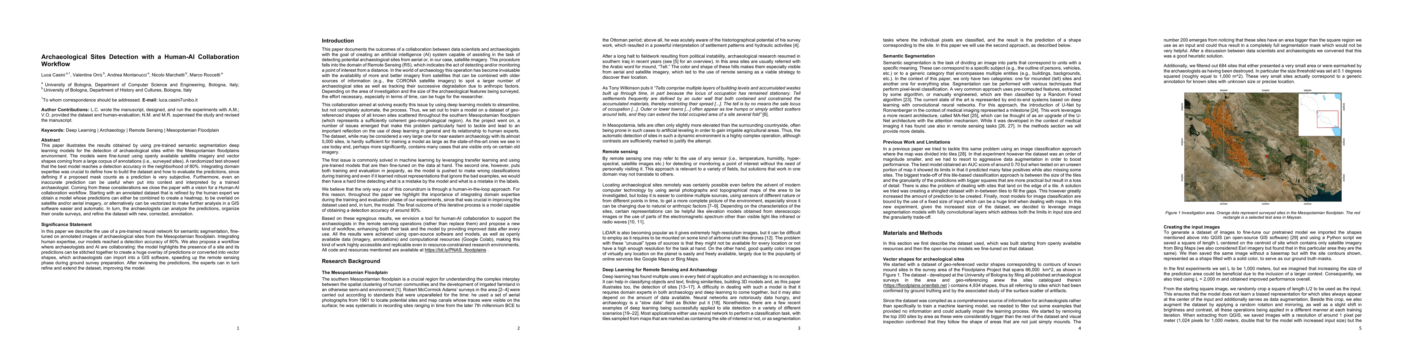
Current paper (gray), citations (green), references (blue)
Display is limited for performance on very large graphs.
Discussion 0