Assessment of OGC Web Processing Services for REST principles
Publication
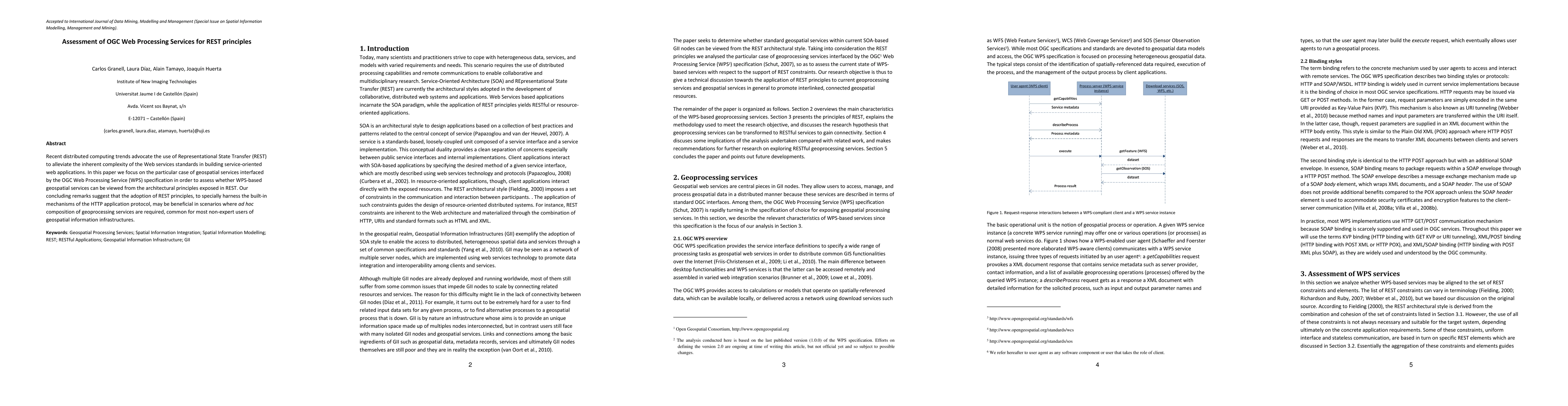
Metrics
AI Quick Summary
This paper evaluates the alignment of OGC Web Processing Services (WPS) with REST principles, finding that adopting REST can enhance the composition of geoprocessing services, particularly for non-expert users of geospatial information systems.
Paper Preview
Abstract
Recent distributed computing trends advocate the use of Representational State Transfer (REST) to alleviate the inherent complexity of the Web services standards in building service-oriented web applications. In this paper we focus on the particular case of geospatial services interfaced by the OGC Web Processing Service (WPS) specification in order to assess whether WPS-based geospatial services can be viewed from the architectural principles exposed in REST. Our concluding remarks suggest that the adoption of REST principles, to specially harness the built-in mechanisms of the HTTP application protocol, may be beneficial in scenarios where ad hoc composition of geoprocessing services are required, common for most non-expert users of geospatial information infrastructures.
AI Key Findings
Get AI-generated insights about this paper's methodology, results, significance, and more — seven facets brought into focus.
Impact
Paper Details
PDF Preview
Key Terms
Citation Network
Current paper (gray), citations (green), references (blue)
Display is limited for performance on very large graphs.
Discussion 0