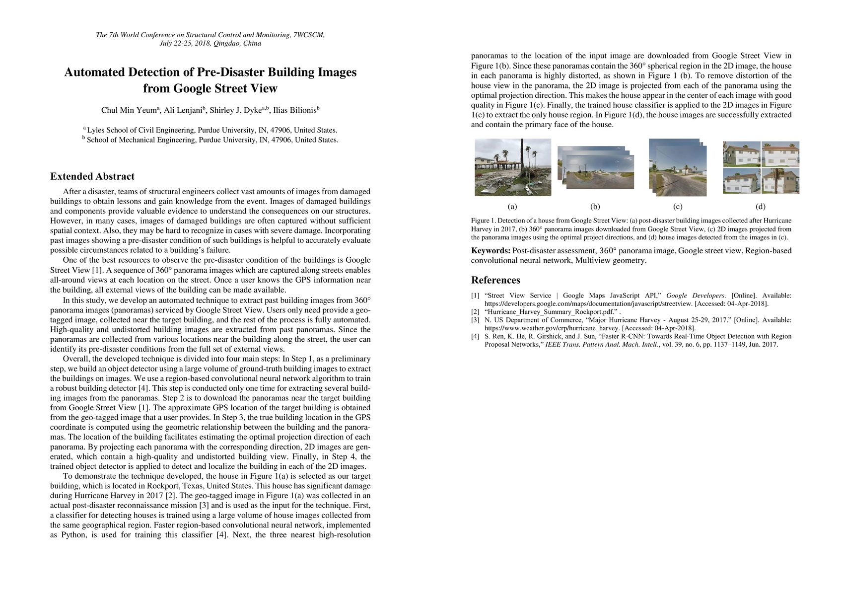
Summary
After a disaster, teams of structural engineers collect vast amounts of images from damaged buildings to obtain lessons and gain knowledge from the event. Images of damaged buildings and components provide valuable evidence to understand the consequences on our structures. However, in many cases, images of damaged buildings are often captured without sufficient spatial context. Also, they may be hard to recognize in cases with severe damage. Incorporating past images showing a pre-disaster condition of such buildings is helpful to accurately evaluate possible circumstances related to a building's failure. One of the best resources to observe the pre-disaster condition of the buildings is Google Street View. A sequence of 360 panorama images which are captured along streets enables all-around views at each location on the street. Once a user knows the GPS information near the building, all external views of the building can be made available. In this study, we develop an automated technique to extract past building images from 360 panorama images serviced by Google Street View. Users only need to provide a geo-tagged image, collected near the target building, and the rest of the process is fully automated. High-quality and undistorted building images are extracted from past panoramas. Since the panoramas are collected from various locations near the building along the street, the user can identify its pre-disaster conditions from the full set of external views.
AI Key Findings
Get AI-generated insights about this paper's methodology, results, and significance.
Paper Details
PDF Preview
Key Terms
Citation Network
Current paper (gray), citations (green), references (blue)
Display is limited for performance on very large graphs.
Similar Papers
Found 4 papersHyperlocal disaster damage assessment using bi-temporal street-view imagery and pre-trained vision models
Lei Zou, Yifan Yang, Binbin Lin et al.
ELEV-VISION: Automated Lowest Floor Elevation Estimation from Segmenting Street View Images
Ali Mostafavi, Yu-Hsuan Ho, Cheng-Chun Lee et al.
| Title | Authors | Year | Actions |
|---|
Comments (0)