Automated Map Reading: Image Based Localisation in 2-D Maps Using Binary Semantic Descriptors
Publication
Metrics
AI Quick Summary
This research introduces a novel method for image-based localization in urban environments using binary semantic descriptors to match images with a 2-D map, contrasting with traditional image-to-image database matching. The method leverages compact binary descriptors for semantic features, enhancing scalability and invariance to varying conditions, and is more aligned with human map reading. Experimental results demonstrate promising localization accuracy of around 85% over routes of approximately 200 meters using Google StreetView and OpenStreetMap data.
Paper Preview
Abstract
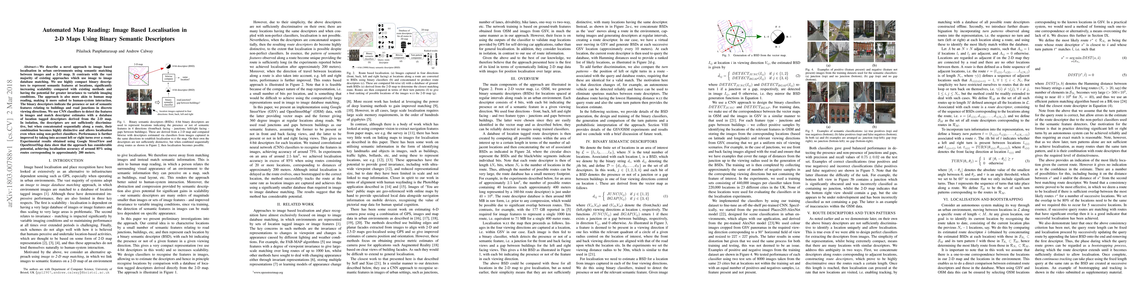
We describe a novel approach to image based localisation in urban environments using semantic matching between images and a 2-D map. It contrasts with the vast majority of existing approaches which use image to image database matching. We use highly compact binary descriptors to represent semantic features at locations, significantly increasing scalability compared with existing methods and having the potential for greater invariance to variable imaging conditions. The approach is also more akin to human map reading, making it more suited to human-system interaction. The binary descriptors indicate the presence or not of semantic features relating to buildings and road junctions in discrete viewing directions. We use CNN classifiers to detect the features in images and match descriptor estimates with a database of location tagged descriptors derived from the 2-D map. In isolation, the descriptors are not sufficiently discriminative, but when concatenated sequentially along a route, their combination becomes highly distinctive and allows localisation even when using non-perfect classifiers. Performance is further improved by taking into account left or right turns over a route. Experimental results obtained using Google StreetView and OpenStreetMap data show that the approach has considerable potential, achieving localisation accuracy of around 85% using routes corresponding to approximately 200 meters.
AI Key Findings
Get AI-generated insights about this paper's methodology, results, significance, and more — seven facets brought into focus.
Impact
Paper Details
PDF Preview
Key Terms
Citation Network
Current paper (gray), citations (green), references (blue)
Display is limited for performance on very large graphs.
Discussion 0