Automatic detection of overshooting tops and their properties from visible satellite channels
Publication
Metrics
AI Quick Summary
This study introduces an automated method using convolutional neural networks to detect overshooting tops (OTs) in visible satellite imagery, achieving 95% detection accuracy and 0.25 km height estimation error. The approach, validated on a 10,000-case dataset, promises improved performance with newer satellites.
Paper Preview
Abstract
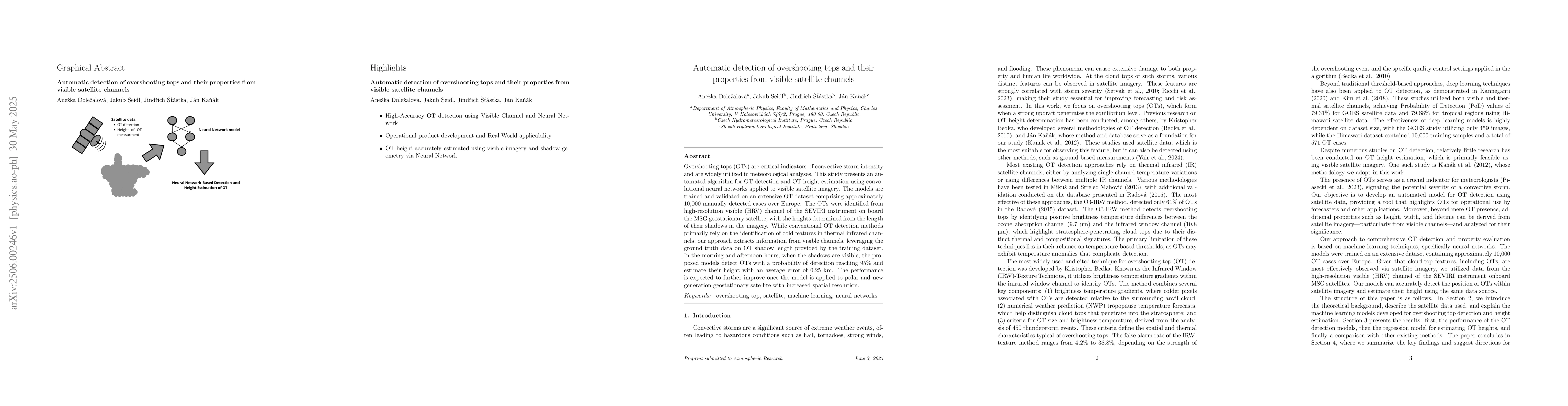
Overshooting tops (OTs) are critical indicators of convective storm intensity and are widely utilized in meteorological analyses. This study presents an automated algorithm for OT detection and OT height estimation using convolutional neural networks applied to visible satellite imagery. The models are trained and validated on an extensive OT dataset comprising approximately 10,000 manually detected cases over Europe. The OTs were identified from high-resolution visible (HRV) channel of the SEVIRI instrument on board the MSG geostationary satellite, with the heights determined from the length of their shadows in the imagery. While conventional OT detection methods primarily rely on the identification of cold features in thermal infrared channels, our approach extracts information from visible channels, leveraging the ground truth data on OT shadow length provided by the training dataset. In the morning and afternoon hours, when the shadows are visible, the proposed models detect OTs with a probability of detection reaching 95% and estimate their height with an average error of 0.25 km. The performance is expected to further improve once the model is applied to polar and new generation geostationary satellite with increased spatial resolution.
AI Key Findings
Get AI-generated insights about this paper's methodology, results, significance, and more — seven facets brought into focus.
Authors
PDF Preview
Related Papers
No references found for this paper.
Discussion 0