Automatic Odometry-Less OpenDRIVE Generation From Sparse Point Clouds
Publication
Metrics
AI Quick Summary
This paper introduces a method to autonomously create high-definition road maps from sparse point cloud data, focusing on odometry-less generation using the OpenDRIVE format for virtual test drives in automated driving simulations. The approach aims to eliminate the need for sensor fusion, machine learning, or precise calibration.
Paper Preview
Abstract
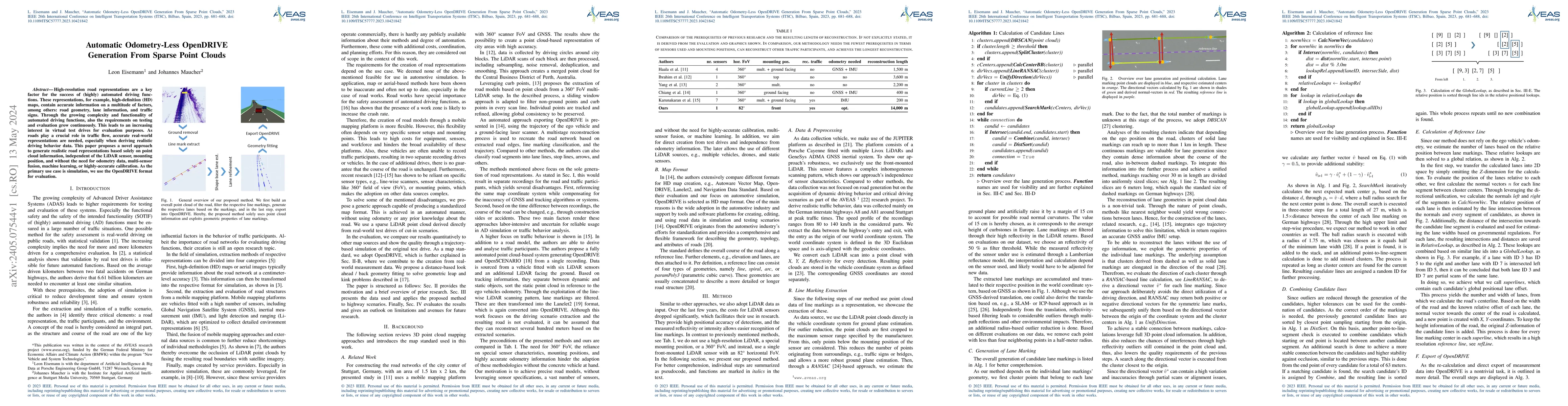
High-resolution road representations are a key factor for the success of (highly) automated driving functions. These representations, for example, high-definition (HD) maps, contain accurate information on a multitude of factors, among others: road geometry, lane information, and traffic signs. Through the growing complexity and functionality of automated driving functions, also the requirements on testing and evaluation grow continuously. This leads to an increasing interest in virtual test drives for evaluation purposes. As roads play a crucial role in traffic flow, accurate real-world representations are needed, especially when deriving realistic driving behavior data. This paper proposes a novel approach to generate realistic road representations based solely on point cloud information, independent of the LiDAR sensor, mounting position, and without the need for odometry data, multi-sensor fusion, machine learning, or highly-accurate calibration. As the primary use case is simulation, we use the OpenDRIVE format for evaluation.
AI Key Findings
Get AI-generated insights about this paper's methodology, results, significance, and more — seven facets brought into focus.
Impact
Paper Details
Authors
PDF Preview
Key Terms
Citation Network
Current paper (gray), citations (green), references (blue)
Display is limited for performance on very large graphs.
Discussion 0