Authors
Summary
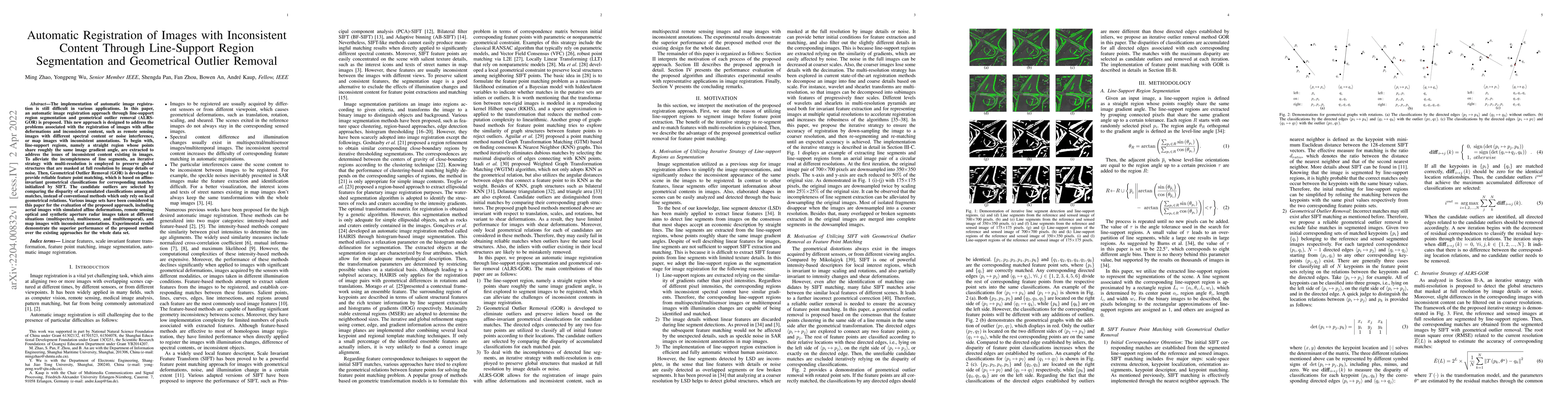
The implementation of automatic image registration is still difficult in various applications. In this paper, an automatic image registration approach through line-support region segmentation and geometrical outlier removal (ALRS-GOR) is proposed. This new approach is designed to address the problems associated with the registration of images with affine deformations and inconsistent content, such as remote sensing images with different spectral content or noise interference, or map images with inconsistent annotations. To begin with, line-support regions, namely a straight region whose points share roughly the same image gradient angle, are extracted to address the issues of inconsistent content existing in images. To alleviate the incompleteness of line segments, an iterative strategy with multi-resolution is employed to preserve global structures that are masked at full resolution by image details or noise. Then, Geometrical Outlier Removal (GOR) is developed to provide reliable feature point matching, which is based on affineinvariant geometrical classifications for corresponding matches initialized by SIFT. The candidate outliers are selected by comparing the disparity of accumulated classifications among all matches, instead of conventional methods which only rely on local geometrical relations. Various image sets have been considered in this paper for the evaluation of the proposed approach, including aerial images with simulated affine deformations, remote sensing optical and synthetic aperture radar images taken at different situations (multispectral, multisensor, and multitemporal), and map images with inconsistent annotations. Experimental results demonstrate the superior performance of the proposed method over the existing approaches for the whole data set.
AI Key Findings
Get AI-generated insights about this paper's methodology, results, and significance.
Paper Details
PDF Preview
Key Terms
Citation Network
Current paper (gray), citations (green), references (blue)
Display is limited for performance on very large graphs.
Similar Papers
Found 4 papersSGOR: Outlier Removal by Leveraging Semantic and Geometric Information for Robust Point Cloud Registration
Guiyu Zhao, Hongbin Ma, Zhentao Guo
Automatic High Resolution Wire Segmentation and Removal
Humphrey Shi, Yuqian Zhou, Zhe Lin et al.
| Title | Authors | Year | Actions |
|---|
Comments (0)