Autonomous Vision-Aided UAV Positioning for Obstacle-Aware Wireless Connectivity
Publication
Metrics
Paper Preview
Abstract
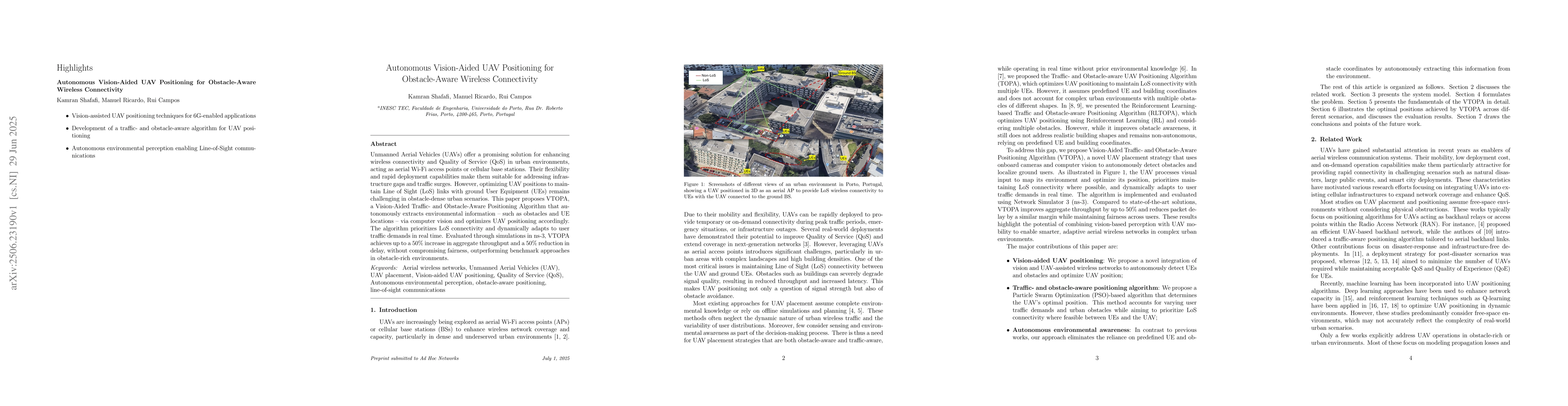
Unmanned Aerial Vehicles (UAVs) offer a promising solution for enhancing wireless connectivity and Quality of Service (QoS) in urban environments, acting as aerial Wi-Fi access points or cellular base stations. Their flexibility and rapid deployment capabilities make them suitable for addressing infrastructure gaps and traffic surges. However, optimizing UAV positions to maintain Line of Sight (LoS) links with ground User Equipment (UEs) remains challenging in obstacle-dense urban scenarios. This paper proposes VTOPA, a Vision-Aided Traffic- and Obstacle-Aware Positioning Algorithm that autonomously extracts environmental information -- such as obstacles and UE locations -- via computer vision and optimizes UAV positioning accordingly. The algorithm prioritizes LoS connectivity and dynamically adapts to user traffic demands in real time. Evaluated through simulations in ns-3, VTOPA achieves up to a 50% increase in aggregate throughput and a 50% reduction in delay, without compromising fairness, outperforming benchmark approaches in obstacle-rich environments.
AI Key Findings
Get AI-generated insights about this paper's methodology, results, significance, and more — seven facets brought into focus.
Impact
Authors
PDF Preview
Citation Network
Current paper (gray), citations (green), references (blue)
Display is limited for performance on very large graphs.
Discussion 0