Bayesian Doppler Imaging: Simultaneous Inference of Surface Maps and Geometric Parameters
Publication
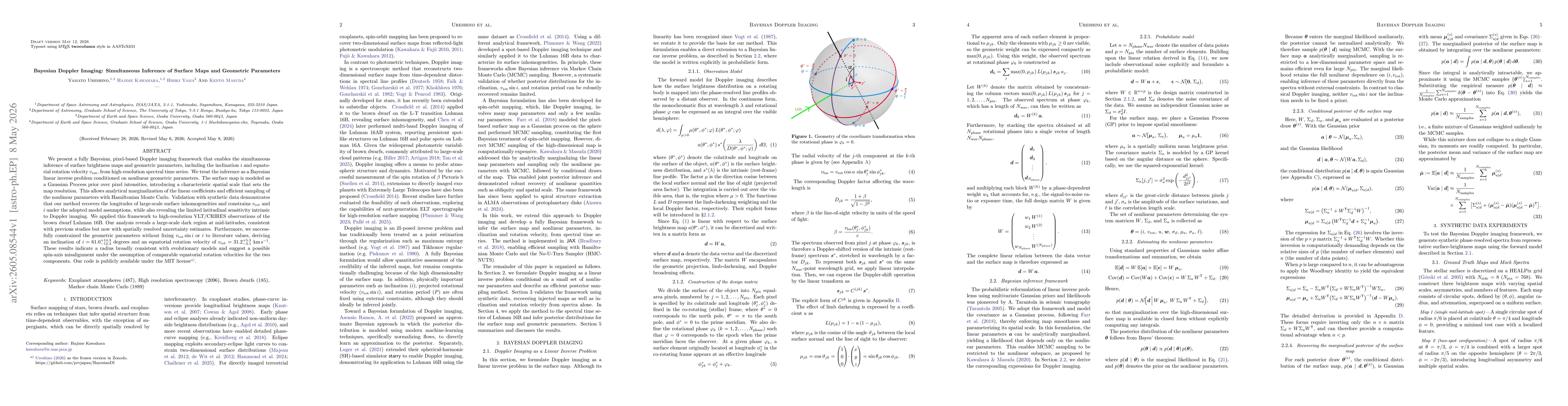
Metrics
Paper Preview
Abstract
We present a fully Bayesian, pixel-based Doppler imaging framework that enables the simultaneous inference of surface brightness maps and geometric parameters, including the inclination $i$ and equatorial rotation velocity $v_{\mathrm{rot}}$, from high-resolution spectral time series. We treat the inference as a Bayesian linear inverse problem conditioned on nonlinear geometric parameters. The surface map is modeled as a Gaussian Process prior over pixel intensities, introducing a characteristic spatial scale that sets the map resolution. This allows analytical marginalization of the linear coefficients and efficient sampling of the nonlinear parameters with Hamiltonian Monte Carlo. {Validation with synthetic data demonstrates that our method recovers the longitudes of large-scale surface inhomogeneities and constrains $v_{\mathrm{rot}}$ and $i$ under the adopted model assumptions, while also revealing the limited latitudinal sensitivity intrinsic to Doppler imaging.} We applied this framework to high-resolution VLT/CRIRES observations of the brown dwarf Luhman 16B. Our analysis reveals a large-scale dark region at mid-latitudes, consistent with previous studies but now with spatially resolved uncertainty estimates. Furthermore, we successfully constrained the geometric parameters without fixing \(v_{\mathrm{rot}}\sin i\) or $i$ to literature values, deriving an inclination of $i = 61.0_{-12.3}^{+14.3}$ degrees and an equatorial rotation velocity of $v_{\mathrm{rot}} = 31.2_{-3.1}^{+5.3}~\mathrm{km\,s^{-1}}$. These results indicate a radius broadly consistent with evolutionary models and suggest a possible spin-axis misalignment under the assumption of comparable equatorial rotation velocities for the two components. Our code is publicly available under the MIT license.
AI Key Findings
Get AI-generated insights about this paper's methodology, results, significance, and more — seven facets brought into focus.
Discussion 0