Beyond Data, Towards Sustainability: A Sydney Case Study on Urban Digital Twins
Publication
Metrics
AI Quick Summary
This Sydney-based case study examines the urban digital twin—a virtual city replica—integrating diverse real-time data to enhance sustainability. It explores applications like spatial ranking and predictive modeling for traffic crash risks, showcasing data-driven proactive interventions for urban planning.
Paper Preview
Abstract
As urban areas grapple with unprecedented challenges stemming from population growth and climate change, the emergence of urban digital twins offers a promising solution. This paper presents a case study focusing on Sydney's urban digital twin, a virtual replica integrating diverse real-time and historical data, including weather, crime, emissions, and traffic. Through advanced visualization and data analysis techniques, the study explores some applications of this digital twin in urban sustainability, such as spatial ranking of suburbs and automatic identification of correlations between variables. Additionally, the research delves into predictive modeling, employing machine learning to forecast traffic crash risks using environmental data, showcasing the potential for proactive interventions. The contributions of this work lie in the comprehensive exploration of a city-scale digital twin for sustainable urban planning, offering a multifaceted approach to data-driven decision-making.
AI Key Findings
Get AI-generated insights about this paper's methodology, results, significance, and more — seven facets brought into focus.
Impact
Paper Details
Authors
PDF Preview
Key Terms
Citation Network
Current paper (gray), citations (green), references (blue)
Display is limited for performance on very large graphs.
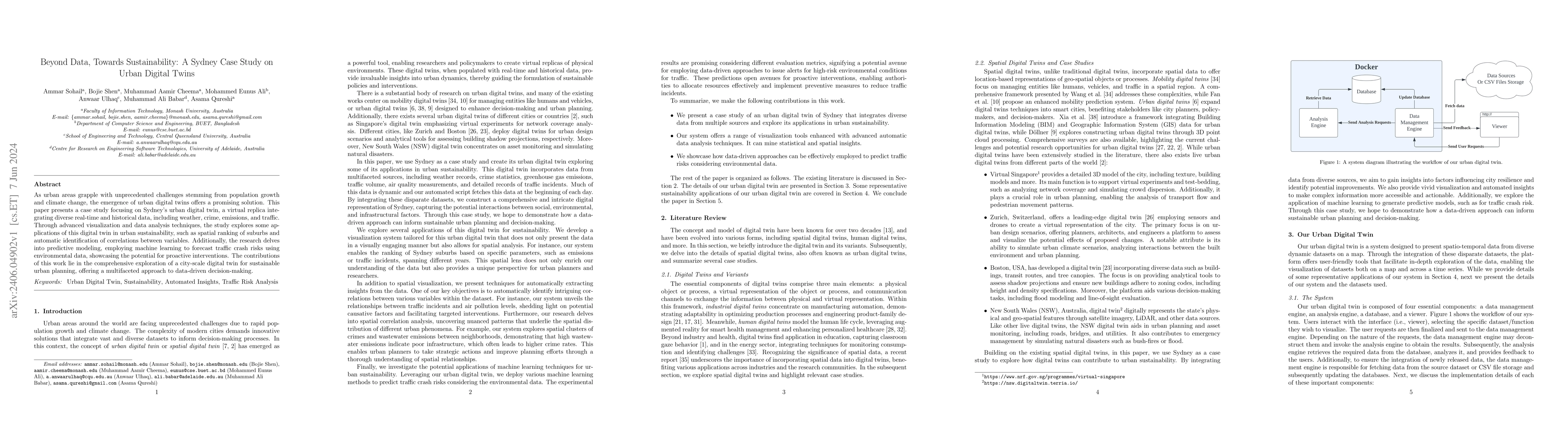
Discussion 0