Bi-Level Image-Guided Ergodic Exploration with Applications to Planetary Rovers
Publication
Metrics
AI Quick Summary
This paper proposes a bi-level image-guided ergodic exploration method for mobile robots, enhancing complete coverage with an object detection classifier. Applied to Mars rovers, it improves rock formation localization and reduces exploration path length.
Paper Preview
Abstract
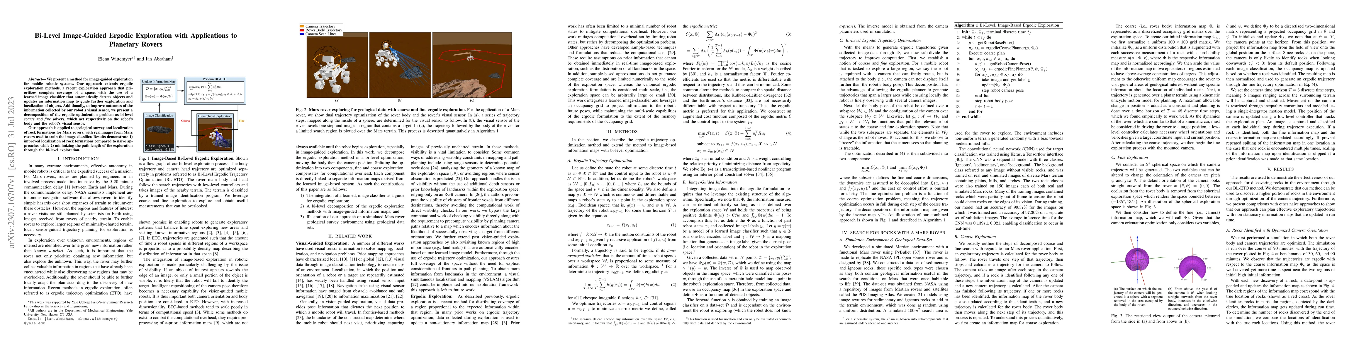
We present a method for image-guided exploration for mobile robotic systems. Our approach extends ergodic exploration methods, a recent exploration approach that prioritizes complete coverage of a space, with the use of a learned image classifier that automatically detects objects and updates an information map to guide further exploration and localization of objects. Additionally, to improve outcomes of the information collected by our robot's visual sensor, we present a decomposition of the ergodic optimization problem as bi-level coarse and fine solvers, which act respectively on the robot's body and the robot's visual sensor. Our approach is applied to geological survey and localization of rock formations for Mars rovers, with real images from Mars rovers used to train the image classifier. Results demonstrate 1) improved localization of rock formations compared to naive approaches while 2) minimizing the path length of the exploration through the bi-level exploration.
AI Key Findings
Get AI-generated insights about this paper's methodology, results, significance, and more — seven facets brought into focus.
Impact
Paper Details
Authors
PDF Preview
Key Terms
Citation Network
Current paper (gray), citations (green), references (blue)
Display is limited for performance on very large graphs.
Discussion 0