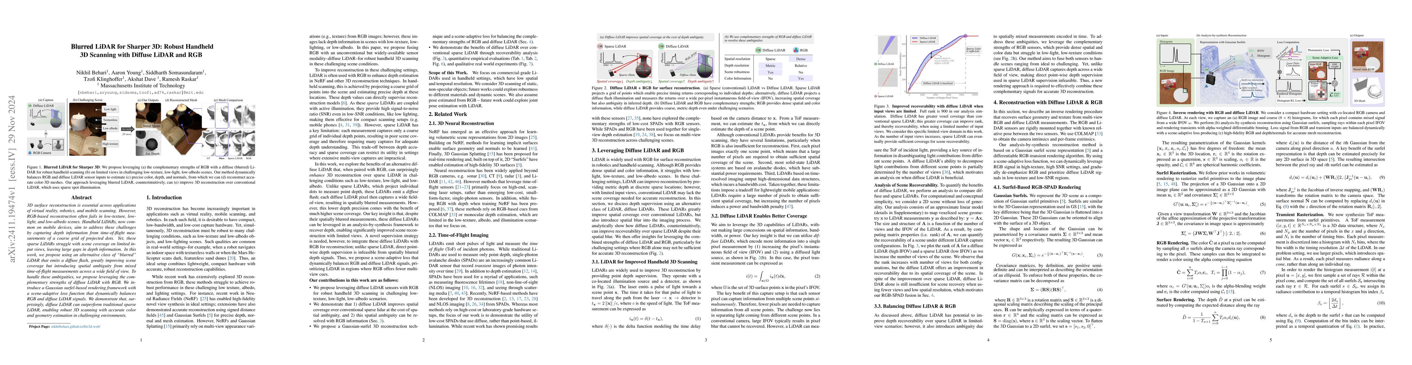
3D surface reconstruction is essential across applications of virtual
reality, robotics, and mobile scanning. However, RGB-based reconstruction often
fails in low-texture, low-light, and low-albedo scenes. Handheld LiDARs, now
common on mobile devices, aim to address these challenges by capturing depth
information from time-of-flight measurements of a coarse grid of projected
dots. Yet, these sparse LiDARs struggle with scene coverage on limited input
views, leaving large gaps in depth information. In this work, we propose using
an alternative class of "blurred" LiDAR that emits a diffuse flash, greatly
improving scene coverage but introducing spatial ambiguity from mixed
time-of-flight measurements across a wide field of view. To handle these
ambiguities, we propose leveraging the complementary strengths of diffuse LiDAR
with RGB. We introduce a Gaussian surfel-based rendering framework with a
scene-adaptive loss function that dynamically balances RGB and diffuse LiDAR
signals. We demonstrate that, surprisingly, diffuse LiDAR can outperform
traditional sparse LiDAR, enabling robust 3D scanning with accurate color and
geometry estimation in challenging environments.
Discussion 0