Summary
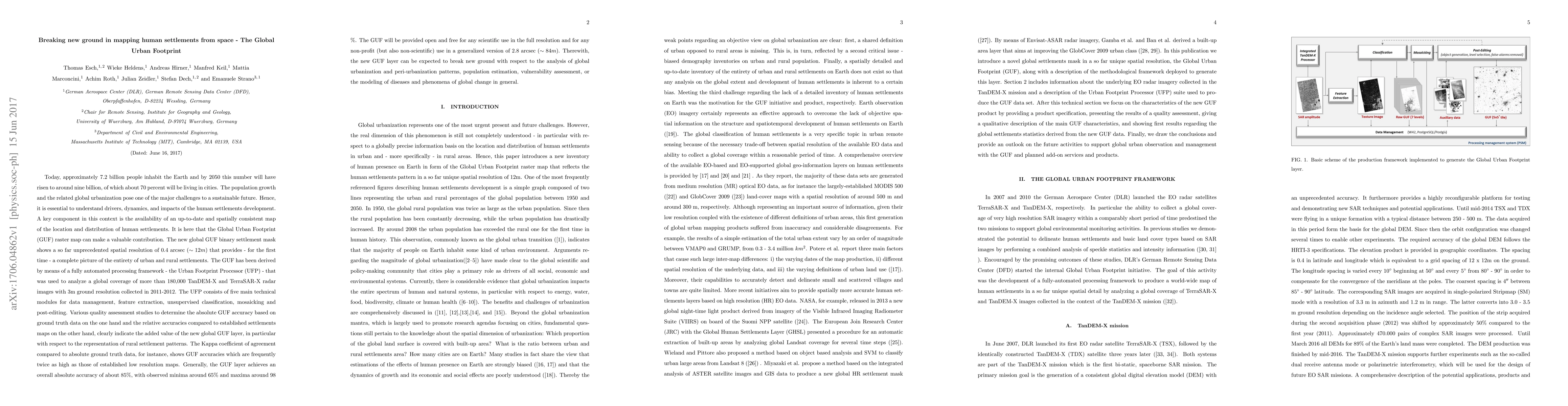
Today 7.2 billion people inhabit the Earth and by 2050 this number will have risen to around nine billion, of which about 70 percent will be living in cities. Hence, it is essential to understand drivers, dynamics, and impacts of the human settlements development. A key component in this context is the availability of an up-to-date and spatially consistent map of the location and distribution of human settlements. It is here that the Global Urban Footprint (GUF) raster map can make a valuable contribution. The new global GUF binary settlement mask shows a so far unprecedented spatial resolution of 0.4 arcsec ($\sim12 m$) that provides - for the first time - a complete picture of the entirety of urban and rural settlements. The GUF has been derived by means of a fully automated processing framework - the Urban Footprint Processor (UFP) - that was used to analyze a global coverage of more than 180,000 TanDEM-X and TerraSAR-X radar images with 3m ground resolution collected in 2011-2012. Various quality assessment studies to determine the absolute GUF accuracy based on ground truth data on the one hand and the relative accuracies compared to established settlements maps on the other hand, clearly indicate the added value of the new global GUF layer, in particular with respect to the representation of rural settlement patterns. Generally, the GUF layer achieves an overall absolute accuracy of about 85\%, with observed minima around 65\% and maxima around 98 \%. The GUF will be provided open and free for any scientific use in the full resolution and for any non-profit (but also non-scientific) use in a generalized version of 2.8 arcsec ($\sim84m$). Therewith, the new GUF layer can be expected to break new ground with respect to the analysis of global urbanization and peri-urbanization patterns, population estimation or vulnerability assessment.
AI Key Findings
Get AI-generated insights about this paper's methodology, results, and significance.
Paper Details
PDF Preview
Key Terms
Citation Network
Current paper (gray), citations (green), references (blue)
Display is limited for performance on very large graphs.
Similar Papers
Found 4 papers| Title | Authors | Year | Actions |
|---|
Comments (0)