01
MethodologyHow they did it
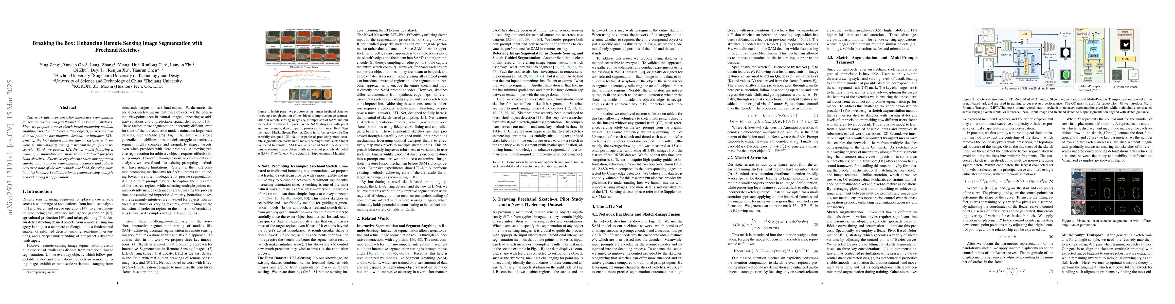
This paper proposes a novel sketch-based prompting method for zero-shot interactive segmentation in remote sensing imagery, introduces LTL-Sensing, the first dataset pairing human sketches with remote sensing imagery, and presents LTL-Net, a model with a multi-input prompting transport module tailored for freehand sketches.
Discussion 0