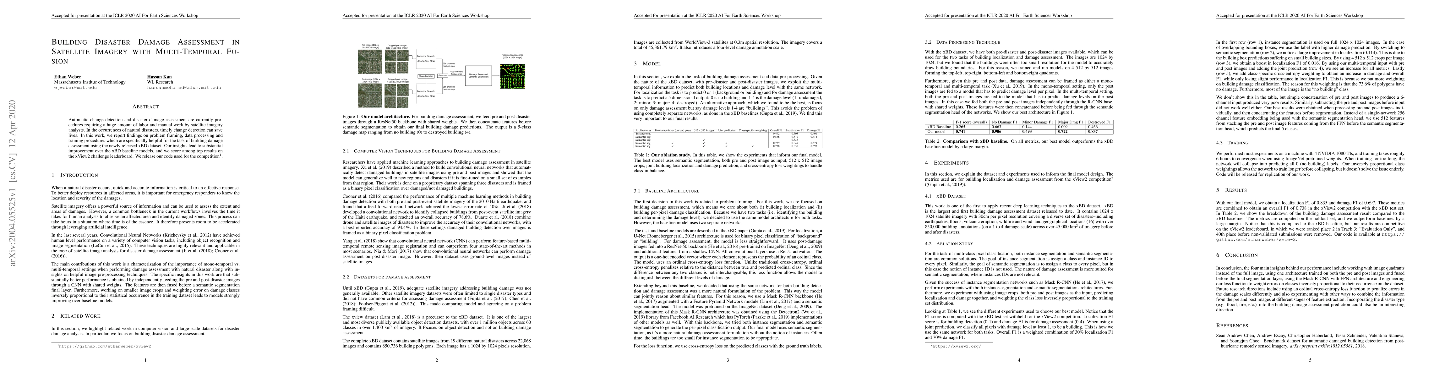
Building Disaster Damage Assessment in Satellite Imagery with Multi-Temporal Fusion
Publication
Metrics
AI Quick Summary
This paper presents an automated method for building damage assessment using multi-temporal satellite imagery fusion, significantly improving upon baseline models and achieving top results in the xView2 challenge. The authors release their code to facilitate further research in this area.
Paper Preview
Abstract
Automatic change detection and disaster damage assessment are currently procedures requiring a huge amount of labor and manual work by satellite imagery analysts. In the occurrences of natural disasters, timely change detection can save lives. In this work, we report findings on problem framing, data processing and training procedures which are specifically helpful for the task of building damage assessment using the newly released xBD dataset. Our insights lead to substantial improvement over the xBD baseline models, and we score among top results on the xView2 challenge leaderboard. We release our code used for the competition.
AI Key Findings
Get AI-generated insights about this paper's methodology, results, significance, and more — seven facets brought into focus.
Impact
Paper Details
Authors
PDF Preview
Key Terms
Citation Network
Current paper (gray), citations (green), references (blue)
Display is limited for performance on very large graphs.
Discussion 0