Built Environment Reasoning from Remote Sensing Imagery Using Large Vision--Language Models
Publication
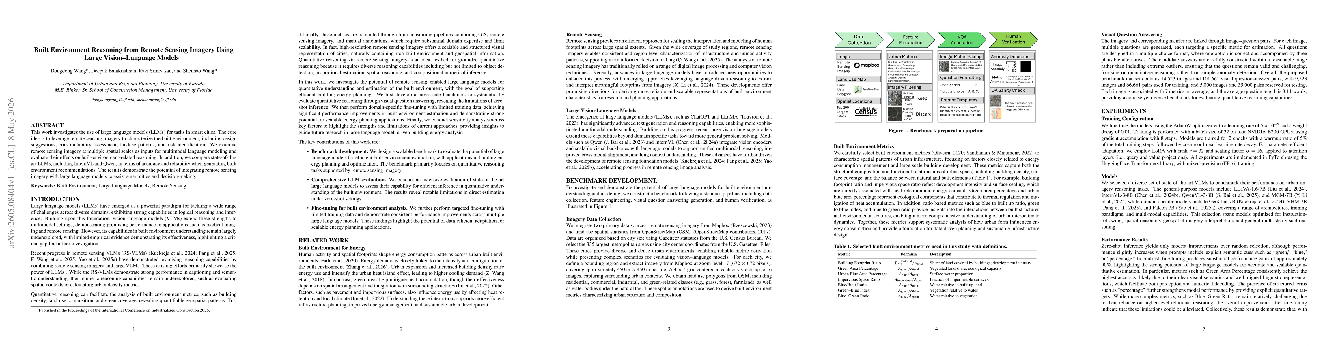
Metrics
Paper Preview
Abstract
This work investigates the use of large language models (LLMs) for tasks in smart cities. The core idea is to leverage remote sensing imagery to characterize the built environment, including design suggestions, constructability assessment, landuse patterns, and risk identification. We examine remote sensing imagery at multiple spatial scales as inputs for multimodal language modeling and evaluate their effects on built-environment-related reasoning. In addition, we compare state-of-the-art LLMs, including InternVL and Qwen, in terms of accuracy and reliability when generating built environment recommendations. The results demonstrate the potential of integrating remote sensing imagery with large language models to assist smart cities and decision-making.
AI Key Findings
Get AI-generated insights about this paper's methodology, results, significance, and more — seven facets brought into focus.
Discussion 0