Publication
Metrics
Paper Preview
Abstract
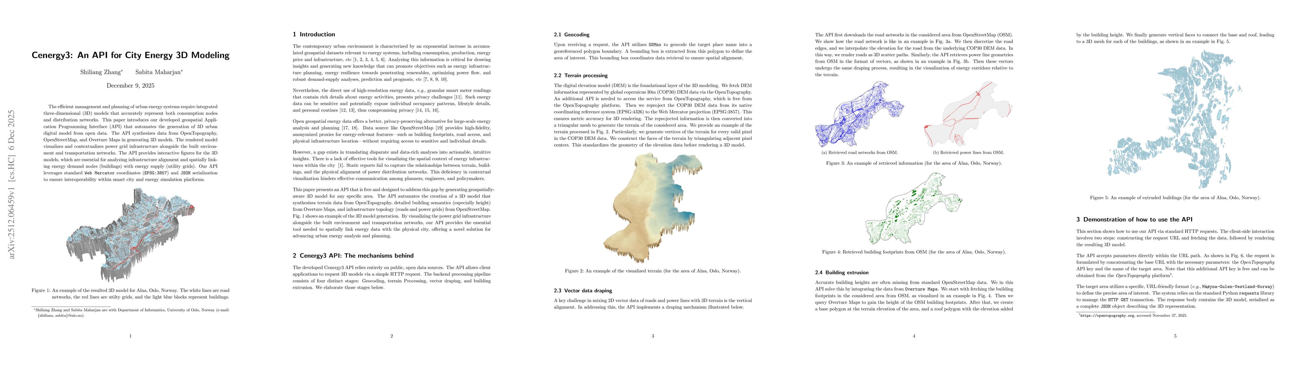
The efficient management and planning of urban energy systems require integrated three-dimensional (3D) models that accurately represent both consumption nodes and distribution networks. This paper introduces our developed geospatial Application Programming Interface (API) that automates the generation of 3D urban digital model from open data. The API synthesizes data from OpenTopography, OpenStreetMap, and Overture Maps in generating 3D models. The rendered model visualizes and contextualizes power grid infrastructure alongside the built environment and transportation networks. The API provides interactive figures for the 3D models, which are essential for analyzing infrastructure alignment and spatially linking energy demand nodes (buildings) with energy supply (utility grids). Our API leverages standard Web Mercator coordinates (EPSG:3857) and JSON serialization to ensure interoperability within smart city and energy simulation platforms.
AI Key Findings
Get AI-generated insights about this paper's methodology, results, significance, and more — seven facets brought into focus.
Discussion 0