Change Detection between Multimodal Remote Sensing Data Using Siamese CNN
Publication
Metrics
AI Quick Summary
This paper proposes a framework for detecting topographic changes in urban environments using multimodal remote sensing data, with 86.4% accuracy.
Paper Preview
Abstract
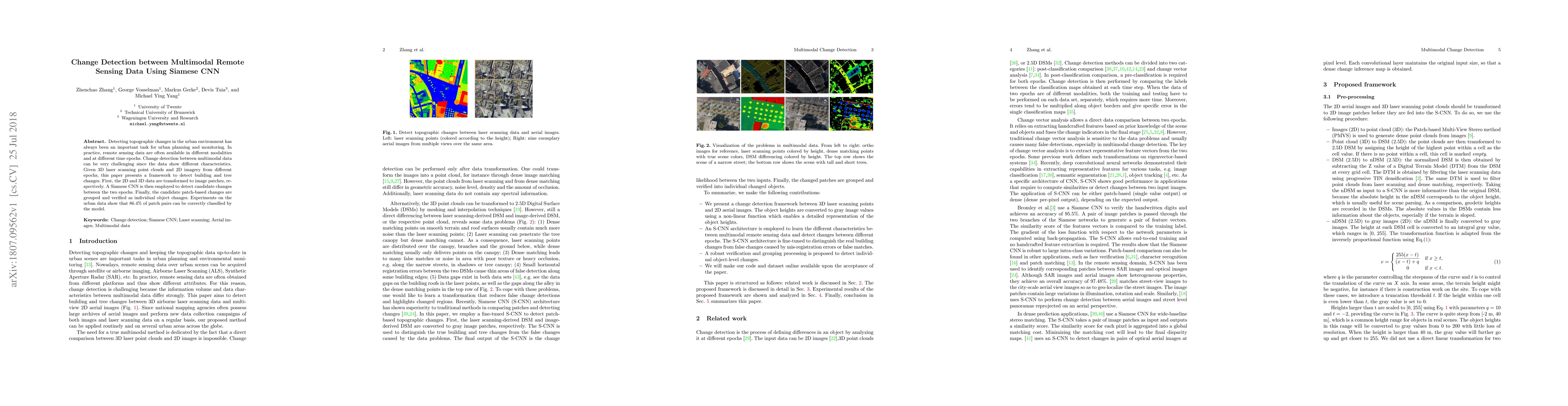
Detecting topographic changes in the urban environment has always been an important task for urban planning and monitoring. In practice, remote sensing data are often available in different modalities and at different time epochs. Change detection between multimodal data can be very challenging since the data show different characteristics. Given 3D laser scanning point clouds and 2D imagery from different epochs, this paper presents a framework to detect building and tree changes. First, the 2D and 3D data are transformed to image patches, respectively. A Siamese CNN is then employed to detect candidate changes between the two epochs. Finally, the candidate patch-based changes are grouped and verified as individual object changes. Experiments on the urban data show that 86.4\% of patch pairs can be correctly classified by the model.
AI Key Findings
Get AI-generated insights about this paper's methodology, results, significance, and more — seven facets brought into focus.
Impact
Paper Details
PDF Preview
Key Terms
Citation Network
Current paper (gray), citations (green), references (blue)
Display is limited for performance on very large graphs.
Discussion 0