01
MethodologyHow they did it
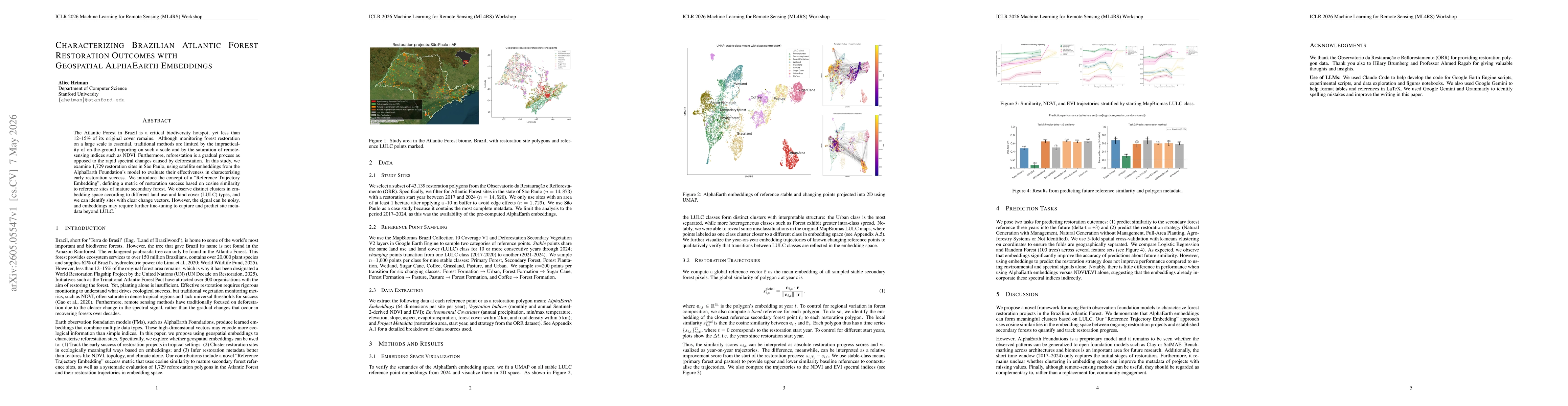
The study uses geospatial embeddings from AlphaEarth Foundation models to characterize restoration sites. It introduces Reference Trajectory Embedding (RTE) as a cosine-similarity metric to mature secondary forest reference embeddings, clusters sites in embedding space by LULC types, and analyzes 1,729 restoration polygons in São Paulo using precomputed embeddings, NDVI/EVI indicators, and environmental covariates to interpret early restoration success.
Discussion 0