Publication
Metrics
AI Quick Summary
This paper introduces a circular-arc cartogram model where countries are represented by polygons with curved edges instead of straight lines, allowing for area distortion based on given values. The authors demonstrate that constructing such cartograms is NP-hard and propose a heuristic method involving max-flow computation and straight skeleton analysis to achieve visually appealing and partially accurate results.
Paper Preview
Abstract
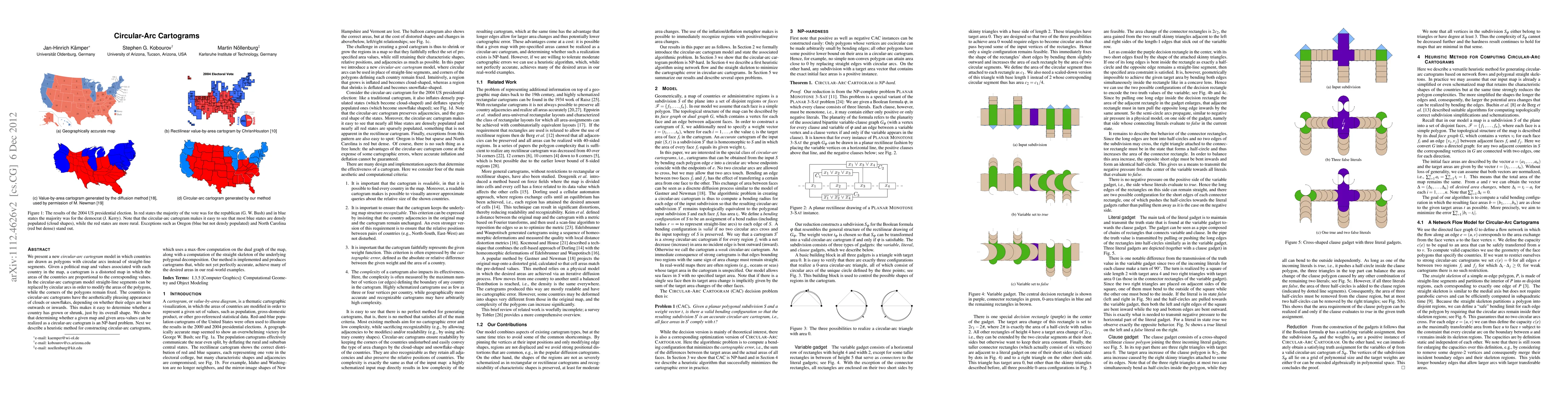
We present a new circular-arc cartogram model in which countries are drawn as polygons with circular arcs instead of straight-line segments. Given a political map and values associated with each country in the map, a cartogram is a distorted map in which the areas of the countries are proportional to the corresponding values. In the circular-arc cartogram model straight-line segments can be replaced by circular arcs in order to modify the areas of the polygons, while the corners of the polygons remain fixed. The countries in circular-arc cartograms have the aesthetically pleasing appearance of clouds or snowflakes, depending on whether their edges are bent outwards or inwards. This makes it easy to determine whether a country has grown or shrunk, just by its overall shape. We show that determining whether a given map and given area-values can be realized as a circular-arc cartogram is an NP-hard problem. Next we describe a heuristic method for constructing circular-arc cartograms, which uses a max-flow computation on the dual graph of the map, along with a computation of the straight skeleton of the underlying polygonal decomposition. Our method is implemented and produces cartograms that, while not yet perfectly accurate, achieve many of the desired areas in our real-world examples.
AI Key Findings
Get AI-generated insights about this paper's methodology, results, significance, and more — seven facets brought into focus.
Impact
Paper Details
PDF Preview
Key Terms
Citation Network
Current paper (gray), citations (green), references (blue)
Display is limited for performance on very large graphs.
Discussion 0