CLIP-Guided Source-Free Object Detection in Aerial Images
Publication
Metrics
AI Quick Summary
The paper proposes a Source-Free Object Detection (SFOD) method to enhance object detection in aerial images through domain adaptation, using a self-training framework guided by CLIP to generate and refine pseudo-labels, achieving superior performance compared to baseline methods. Experimental validation on custom datasets DIOR-C and DIOR-Cloudy confirms the method's effectiveness.
Paper Preview
Abstract
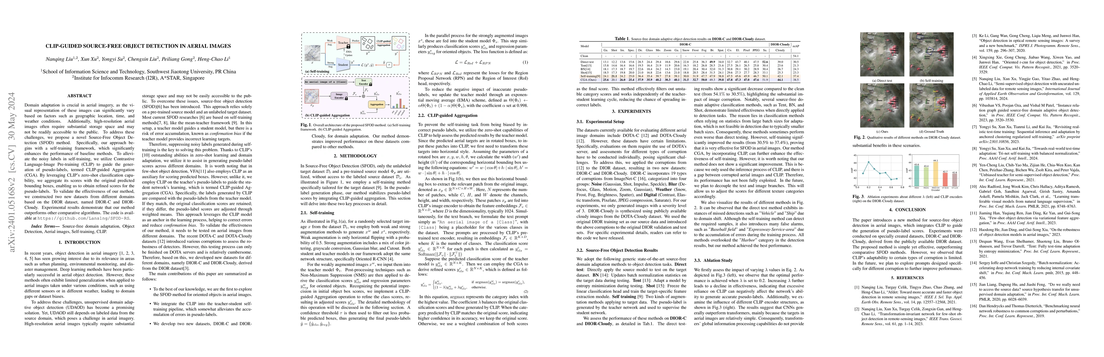
Domain adaptation is crucial in aerial imagery, as the visual representation of these images can significantly vary based on factors such as geographic location, time, and weather conditions. Additionally, high-resolution aerial images often require substantial storage space and may not be readily accessible to the public. To address these challenges, we propose a novel Source-Free Object Detection (SFOD) method. Specifically, our approach begins with a self-training framework, which significantly enhances the performance of baseline methods. To alleviate the noisy labels in self-training, we utilize Contrastive Language-Image Pre-training (CLIP) to guide the generation of pseudo-labels, termed CLIP-guided Aggregation (CGA). By leveraging CLIP's zero-shot classification capability, we aggregate its scores with the original predicted bounding boxes, enabling us to obtain refined scores for the pseudo-labels. To validate the effectiveness of our method, we constructed two new datasets from different domains based on the DIOR dataset, named DIOR-C and DIOR-Cloudy. Experimental results demonstrate that our method outperforms other comparative algorithms. The code is available at https://github.com/Lans1ng/SFOD-RS.
AI Key Findings
Get AI-generated insights about this paper's methodology, results, significance, and more — seven facets brought into focus.
Impact
Paper Details
Authors
PDF Preview
Key Terms
Citation Network
Current paper (gray), citations (green), references (blue)
Display is limited for performance on very large graphs.
Discussion 0