Closure of the sea surface height budget with a Stokes offset
Publication
Metrics
AI Quick Summary
Researchers demonstrate that using GPS buoy measurements as Lagrangian measurements can close the sea surface height budget within understood uncertainties, accounting for a Stokes offset of up to 15 cm.
Paper Preview
Abstract
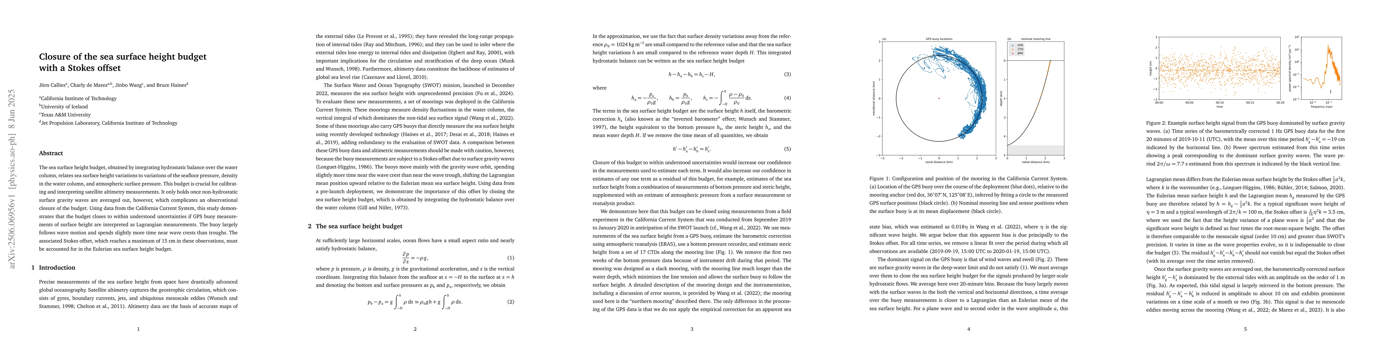
The sea surface height budget, obtained by integrating hydrostatic balance over the water column, relates sea surface height variations to variations of the seafloor pressure, density in the water column, and atmospheric surface pressure. This budget is crucial for calibrating and interpreting satellite altimetry measurements. It only holds once non-hydrostatic surface gravity waves are averaged out, however, which complicates an observational closure of the budget. Using data from the California Current System, this study demonstrates that the budget closes to within understood uncertainties if GPS buoy measurements of surface height are interpreted as Lagrangian measurements. The buoy largely follows wave motion and spends slightly more time near wave crests than troughs. The associated Stokes offset, which reaches a maximum of 15 cm in these observations, must be accounted for in the Eulerian sea surface height budget.
AI Key Findings
Get AI-generated insights about this paper's methodology, results, significance, and more — seven facets brought into focus.
Impact
Authors
PDF Preview
Citation Network
Current paper (gray), citations (green), references (blue)
Display is limited for performance on very large graphs.
Discussion 0