Publication
Metrics
AI Quick Summary
A new clustering technique called CPO is proposed to handle obstacles in spatial databases, dividing areas into cells based on density and obstruction status, and identifying clusters using a breadth-first search algorithm.
Paper Preview
Abstract
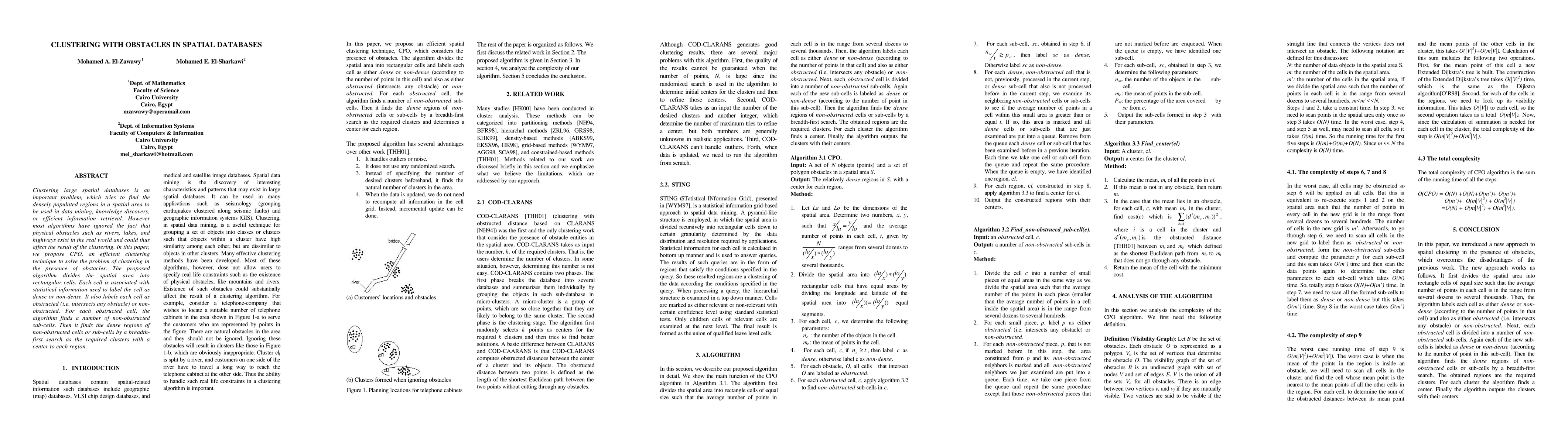
Clustering large spatial databases is an important problem, which tries to find the densely populated regions in a spatial area to be used in data mining, knowledge discovery, or efficient information retrieval. However most algorithms have ignored the fact that physical obstacles such as rivers, lakes, and highways exist in the real world and could thus affect the result of the clustering. In this paper, we propose CPO, an efficient clustering technique to solve the problem of clustering in the presence of obstacles. The proposed algorithm divides the spatial area into rectangular cells. Each cell is associated with statistical information used to label the cell as dense or non-dense. It also labels each cell as obstructed (i.e. intersects any obstacle) or nonobstructed. For each obstructed cell, the algorithm finds a number of non-obstructed sub-cells. Then it finds the dense regions of non-obstructed cells or sub-cells by a breadthfirst search as the required clusters with a center to each region.
AI Key Findings
Get AI-generated insights about this paper's methodology, results, significance, and more — seven facets brought into focus.
Impact
Paper Details
PDF Preview
Key Terms
Citation Network
Current paper (gray), citations (green), references (blue)
Display is limited for performance on very large graphs.
Discussion 0