Authors
Summary
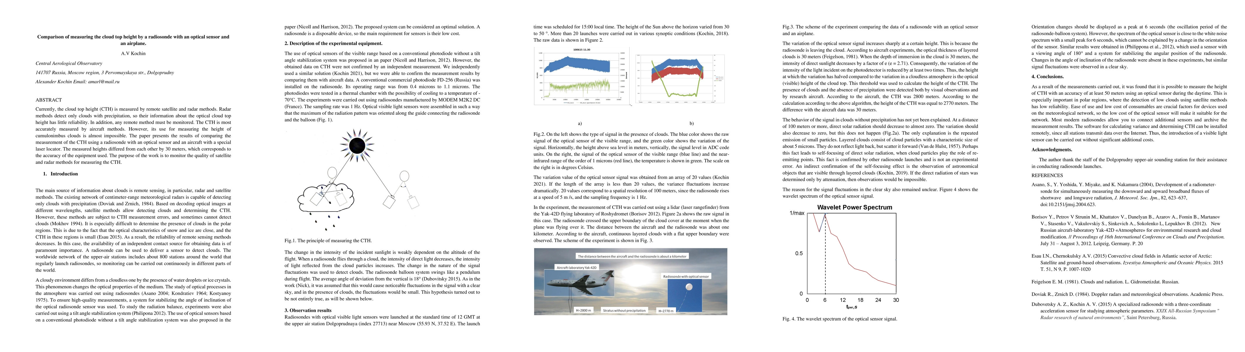
Currently, the cloud top height (CTH) is measured by remote satellite and radar methods. Radar methods detect only clouds with precipitation, so their information about the optical cloud top height has little reliability. In addition, any remote method must be monitored. The CTH is most accurately measured by aircraft methods. However, its use for measuring the height of cumulonimbus clouds is almost impossible. The paper presents the results of comparing the measurement of the CTH using a radiosonde with an optical sensor and an aircraft with a special laser locator. The measured heights differed from each other by 30 meters, which corresponds to the accuracy of the equipment used. The purpose of the work is to monitor the quality of satellite and radar methods for measuring the CTH.
AI Key Findings
Get AI-generated insights about this paper's methodology, results, and significance.
Paper Details
PDF Preview
Key Terms
Citation Network
Current paper (gray), citations (green), references (blue)
Display is limited for performance on very large graphs.
No citations found for this paper.
Comments (0)