Summary

Geocoding is the task of linking a location reference to an actual geographic location and is essential for many downstream analyses of unstructured text. In this paper, we explore the challenging setting of geocoding compositional location references. Building on recent work demonstrating LLMs' abilities to reason over geospatial data, we evaluate LLMs' geospatial knowledge versus reasoning skills relevant to our task. Based on these insights, we propose an LLM-based strategy for geocoding compositional location references. We show that our approach improves performance for the task and that a relatively small fine-tuned LLM can achieve comparable performance with much larger off-the-shelf models.

AI Key Findings

Generated Oct 17, 2025

Methodology

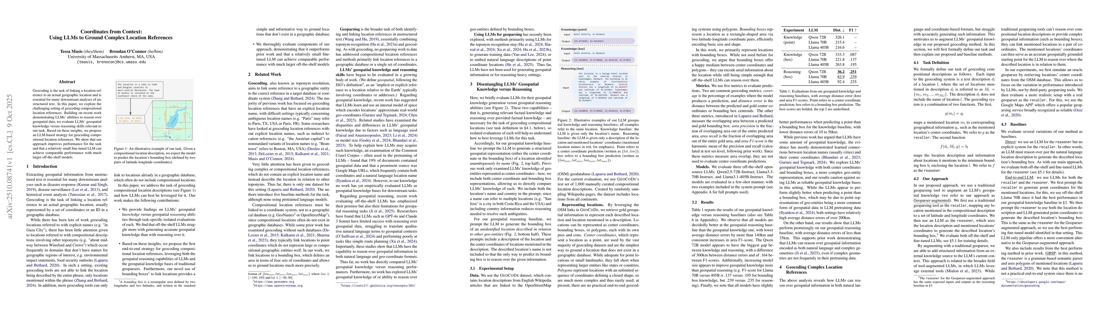
The research employs a comparative analysis of geospatial knowledge and reasoning approaches, evaluating models like Qwen, Llama, and FTQwen using metrics such as coverage, distance, precision, recall, and F1-score. It also examines the impact of Geoparser augmentation and direct parameter-based reasoning.

Key Results

  • Geoparser-augmented models show higher coverage but lower precision compared to direct approaches.
  • Direct reasoning models achieve better accuracy in bounding box predictions, especially for smaller regions.
  • Fine-tuned models (FT) outperform base models in most metrics, indicating the value of domain-specific training.

Significance

This research highlights the trade-offs between different geospatial reasoning methods, offering insights for improving model performance in geographic tasks. It provides a benchmark for future work in location-based AI applications.

Technical Contribution

The study establishes a comprehensive evaluation framework for geospatial reasoning models, comparing multiple architectures and training approaches across various metrics.

Novelty

This work introduces a systematic comparison of Geoparser-augmented versus direct reasoning methods, revealing critical differences in their performance characteristics and application suitability.

Limitations

  • Results may be biased by the specific dataset used (GEOCODE).
  • The study focuses on English-language models, limiting generalizability to other languages.

Future Work

  • Explore multi-lingual geospatial reasoning frameworks.
  • Investigate hybrid approaches combining Geoparser and direct reasoning.
  • Extend evaluations to include more diverse geographic regions and tasks.

Paper Details

PDF Preview

Download PDF

Comments (0)

This website uses cookies to ensure you get the best experience. Learn more