Publication
Metrics
AI Quick Summary
CosFly introduces a modular planning-and-simulation pipeline that converts 3D maps into structured obstacles for UAV planning and then renders multi-modal sensor data (RGB, depth, segmentation) with 6-DOF pose annotations, enabling realistic aerial tracking experiments. The public CosFly-Track dataset provides 250 validated trajectories and ~100k rendered images across diverse environments, supporting both traditional two-stage and direct optimization tracking approaches for improved aerial navigation and perception.
Paper Preview
Abstract
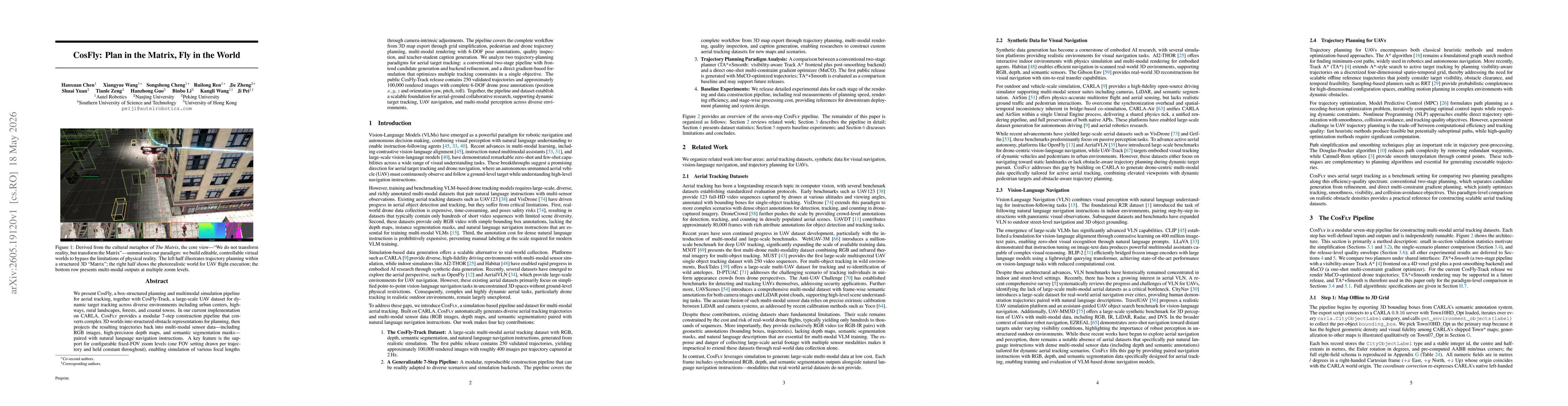
We present CosFly, a box-structured planning and multimodal simulation pipeline for aerial tracking, together with CosFly-Track, a large-scale UAV dataset for dynamic target tracking across diverse environments including urban centers, highways, rural landscapes, forests, and coastal towns. In our current implementation on CARLA, CosFly provides a modular 7-step construction pipeline that converts complex 3D worlds into structured obstacle representations for planning, then projects the resulting trajectories back into multi-modal sensor data -- including RGB images, high-precision depth maps, and semantic segmentation masks -- paired with natural language navigation instructions. A key feature is the support for configurable fixed-FOV zoom levels (one FOV setting drawn per trajectory and held constant throughout), enabling simulation of various focal lengths through camera-intrinsic adjustments. The pipeline covers the complete workflow from 3D map export through grid simplification, pedestrian and drone trajectory planning, multi-modal rendering with 6-DOF pose annotations, quality inspection, and teacher-student caption generation. We analyze two trajectory-planning paradigms for aerial target tracking: a conventional two-stage pipeline with front-end candidate generation and backend refinement, and a direct gradient-based formulation that optimizes multiple tracking constraints in a single objective. The public CosFly-Track release contains 250 validated trajectories and approximately 100,000 rendered images with complete 6-DOF drone pose annotations (position x, y, z and orientation yaw, pitch, roll). Together, the pipeline and dataset establish a scalable foundation for aerial-ground collaborative research, supporting dynamic target tracking, UAV navigation, and multi-modal perception across diverse environments.
AI Key Findings
Get AI-generated insights about this paper's methodology, results, significance, and more — seven facets brought into focus.
Discussion 0