01
MethodologyHow they did it
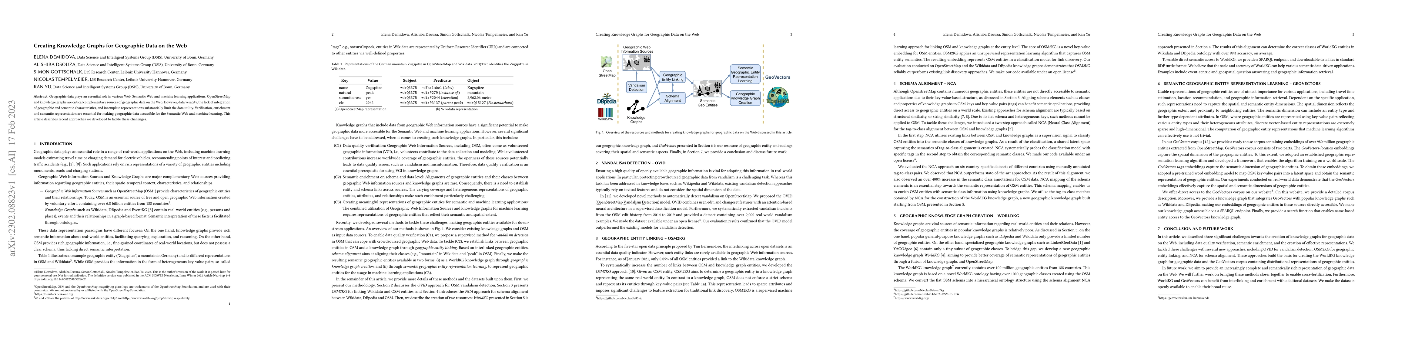
The paper details methods for creating knowledge graphs for geographic data on the web, including OVID for vandalism detection, OSM2KG for geographic entity linking, and NCA for schema alignment. These methods are used to build the WorldKG knowledge graph and GeoVectors corpus.
Discussion 0