Publication
Metrics
AI Quick Summary
Researchers review methods to measure ocean currents remotely using X-band radar images, which alter wave dispersion, and demonstrate agreement with in situ measurements, but highlight the need for further validation.
Paper Preview
Abstract
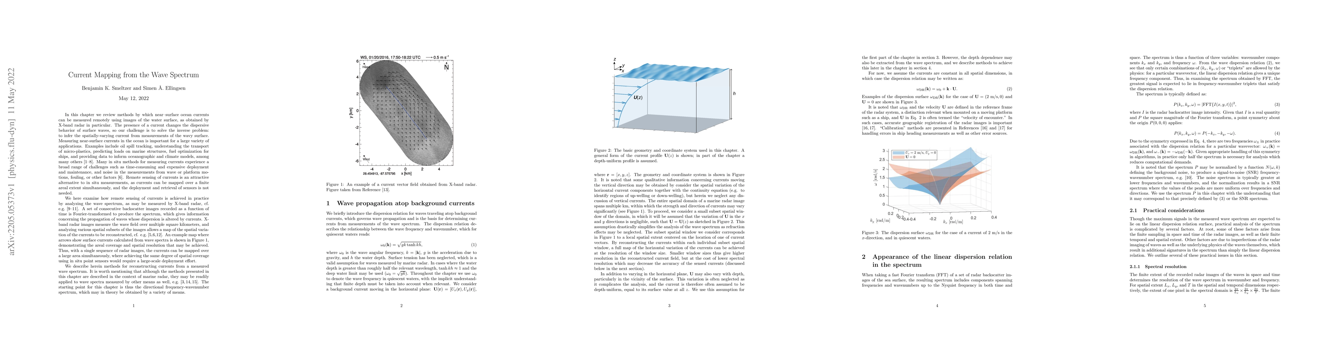
In this chapter we review methods by which near--surface ocean currents can be measured remotely using images of the water surface, as obtained by X-band radar in particular. The presence of a current changes the dispersive behavior of surface waves, so our challenge is to solve the inverse problem: to infer the spatially-varying current from measurements of the wavy surface. We examine how remote sensing of currents is achieved in practice by analyzing the wave spectrum, as may be measured for example by X-band radar. A set of consecutive backscatter images recorded as a function of time is Fourier-transformed to produce the spectrum, which gives information concerning the propagation of waves whose dispersion is altered by currents. X-band radar images measure the wave field over multiple square kilometers, and analyzing various spatial subsets of the images allows a map of the spatial variation of the currents to be reconstructed. Several algorithms for obtaining empirical dispersion relations from the measured spectrum and extracting the currents are reviewed: the least squares and iterative least squares method, the normalized scalar product method, and the polar current shell method. We go on to describe how the same methods and algorithms can be extended to also allowing the depth-dependence of the current to be determined. Reasonable agreement between radar-derived currents and in situ measurements has been demonstrated in multiple field measurements. However, more validation is necessary especially in the context of depth-varying flows. Understanding the extent to which Stokes drift is measured as part of the radar-derived current is not well-understood yet potentially important.
AI Key Findings
Get AI-generated insights about this paper's methodology, results, significance, and more — seven facets brought into focus.
Impact
Paper Details
Authors
PDF Preview
Key Terms
Citation Network
Current paper (gray), citations (green), references (blue)
Display is limited for performance on very large graphs.
Discussion 0