Data-Driven Compute Overlays for Interactive Geographic Simulation and Visualization
Publication
Metrics
Paper Preview
Abstract
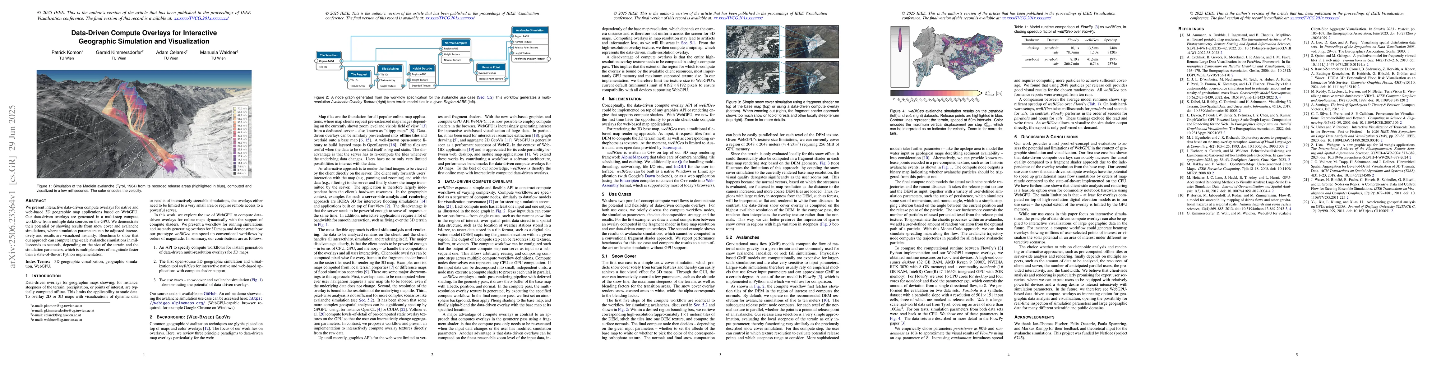
We present interactive data-driven compute overlays for native and web-based 3D geographic map applications based on WebGPU. Our data-driven overlays are generated in a multi-step compute workflow from multiple data sources on the GPU. We demonstrate their potential by showing results from snow cover and avalanche simulations, where simulation parameters can be adjusted interactively and results are visualized instantly. Benchmarks show that our approach can compute large-scale avalanche simulations in milliseconds to seconds, depending on the size of the terrain and the simulation parameters, which is multiple orders of magnitude faster than a state-of-the-art Python implementation.
AI Key Findings
Get AI-generated insights about this paper's methodology, results, significance, and more — seven facets brought into focus.
Impact
Authors
PDF Preview
Citation Network
Current paper (gray), citations (green), references (blue)
Display is limited for performance on very large graphs.
Discussion 0