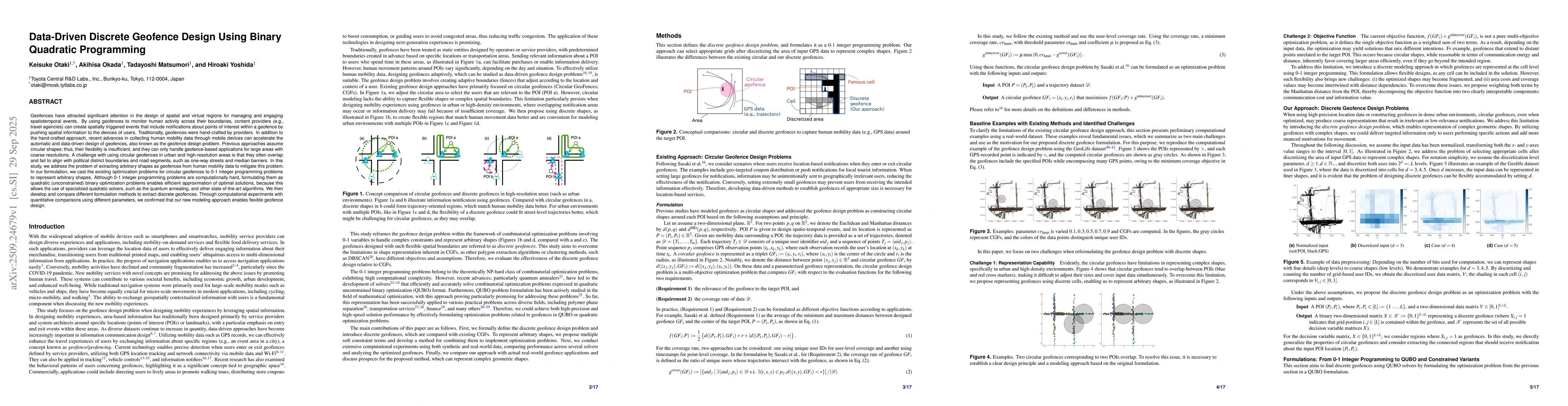
Geofences have attracted significant attention in the design of spatial and
virtual regions for managing and engaging spatiotemporal events. By using
geofences to monitor human activity across their boundaries, content providers
can create spatially triggered events that include notifications about points
of interest within a geofence by pushing spatial information to the devices of
users. Traditionally, geofences were hand-crafted by providers. In addition to
the hand-crafted approach, recent advances in collecting human mobility data
through mobile devices can accelerate the automatic and data-driven design of
geofences, also known as the geofence design problem. Previous approaches
assume circular shapes; thus, their flexibility is insufficient, and they can
only handle geofence-based applications for large areas with coarse
resolutions. A challenge with using circular geofences in urban and
high-resolution areas is that they often overlap and fail to align with
political district boundaries and road segments, such as one-way streets and
median barriers. In this study, we address the problem of extracting arbitrary
shapes as geofences from human mobility data to mitigate this problem. In our
formulation, we cast the existing optimization problems for circular geofences
to 0-1 integer programming problems to represent arbitrary shapes. Although 0-1
integer programming problems are computationally hard, formulating them as
quadratic (unconstrained) binary optimization problems enables efficient
approximation of optimal solutions, because this allows the use of specialized
quadratic solvers, such as the quantum annealing, and other state-of-the-art
algorithms. We then develop and compare different formulation methods to
extract discrete geofences. We confirmed that our new modeling approach enables
flexible geofence design.
Discussion 0