Publication
Metrics
AI Quick Summary
This paper presents new utilities for managing and analyzing wildland fire simulations using WRF and SFIRE, including automated web scrapers for data preprocessing, scripts for domain setup, and integration with Google Earth for 3D exploration. The tools aim to create a unified web application for advanced wildland fire modeling.
Paper Preview
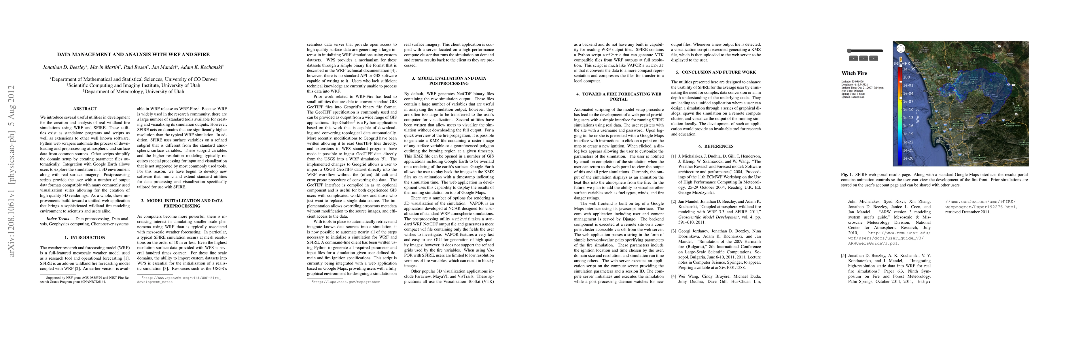
Abstract
We introduce several useful utilities in development for the creation and analysis of real wildland fire simulations using WRF and SFIRE. These utilities exist as standalone programs and scripts as well as extensions to other well known software. Python web scrapers automate the process of downloading and preprocessing atmospheric and surface data from common sources. Other scripts simplify the domain setup by creating parameter files automatically. Integration with Google Earth allows users to explore the simulation in a 3D environment along with real surface imagery. Postprocessing scripts provide the user with a number of output data formats compatible with many commonly used visualization suites allowing for the creation of high quality 3D renderings. As a whole, these improvements build toward a unified web application that brings a sophisticated wildland fire modeling environment to scientists and users alike.
AI Key Findings
Get AI-generated insights about this paper's methodology, results, significance, and more — seven facets brought into focus.
Impact
Paper Details
PDF Preview
Key Terms
Citation Network
Current paper (gray), citations (green), references (blue)
Display is limited for performance on very large graphs.
Discussion 0