Development Of A Fire Detection System On Satellite Images
Publication
Metrics
AI Quick Summary
This paper develops a convolutional neural network for detecting wildfires in satellite images and uses the classification results to build a fuzzy cognitive map for macroeconomic analysis. It explores the potential of hybrid cognitive models for forecasting macroeconomic indicators using wildfire data.
Paper Preview
Abstract
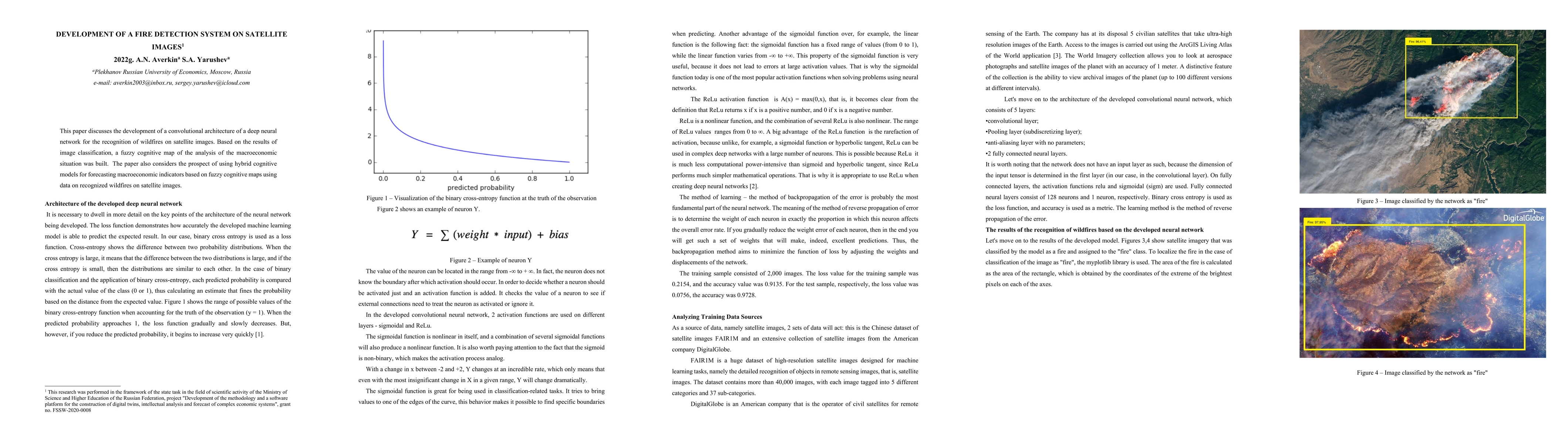
This paper discusses the development of a convolutional architecture of a deep neural network for the recognition of wildfires on satellite images. Based on the results of image classification, a fuzzy cognitive map of the analysis of the macroeconomic situation was built. The paper also considers the prospect of using hybrid cognitive models for forecasting macroeconomic indicators based on fuzzy cognitive maps using data on recognized wildfires on satellite images.
AI Key Findings
Get AI-generated insights about this paper's methodology, results, significance, and more — seven facets brought into focus.
Impact
Paper Details
Authors
PDF Preview
Key Terms
Citation Network
Current paper (gray), citations (green), references (blue)
Display is limited for performance on very large graphs.
Discussion 0