The paper presents four different sensor configurations (helmet-mounted or body-worn) with two mapping algorithms, implemented and evaluated during field trials.
Development of Ultra-Portable 3D Mapping Systems for Emergency Services
Publication
Metrics
AI Quick Summary
The paper details the development of wearable 3D mapping systems for emergency responders, utilizing miniaturized cameras and LiDAR sensors. The study evaluates four sensor configurations and two mapping algorithms, aiming to enhance response capabilities with real-time high-fidelity maps of hazardous environments.
Quick Answers
What is "Development of Ultra-Portable 3D Mapping Systems for Emergency Services" about?
The paper details the development of wearable 3D mapping systems for emergency responders, utilizing miniaturized cameras and LiDAR sensors. The study evaluates four sensor configurations and two mapping algorithms, aiming to enhance response capabilities with real-time high-fidelity maps of hazardous environments.
What methodology did the authors use?
The paper presents four different sensor configurations (helmet-mounted or body-worn) with two mapping algorithms, implemented and evaluated during field trials. More in Methodology →
What are the key results?
Four system configurations were developed and tested in realistic, complex environments. — A custom LVIO method using an error-state iterative Kalman filter (ESIKF) showed promising results in fusing IMU-propagated state estimates with point-to-plane distance residuals and visual-inertial relative pose residuals. More in Key Results →
Why is this work significant?
This research explores the potential of wearable 3D mapping systems for first responders, which could revolutionize emergency response capabilities by providing real-time, high-fidelity maps of dynamic and hazardous environments. More in Significance →
What are the main limitations?
Sensor limitations such as range, field of view, and power consumption can impact mapping performance. — Multi-sensor systems require precise calibration, which is a research topic on its own. More in Limitations →
Abstract
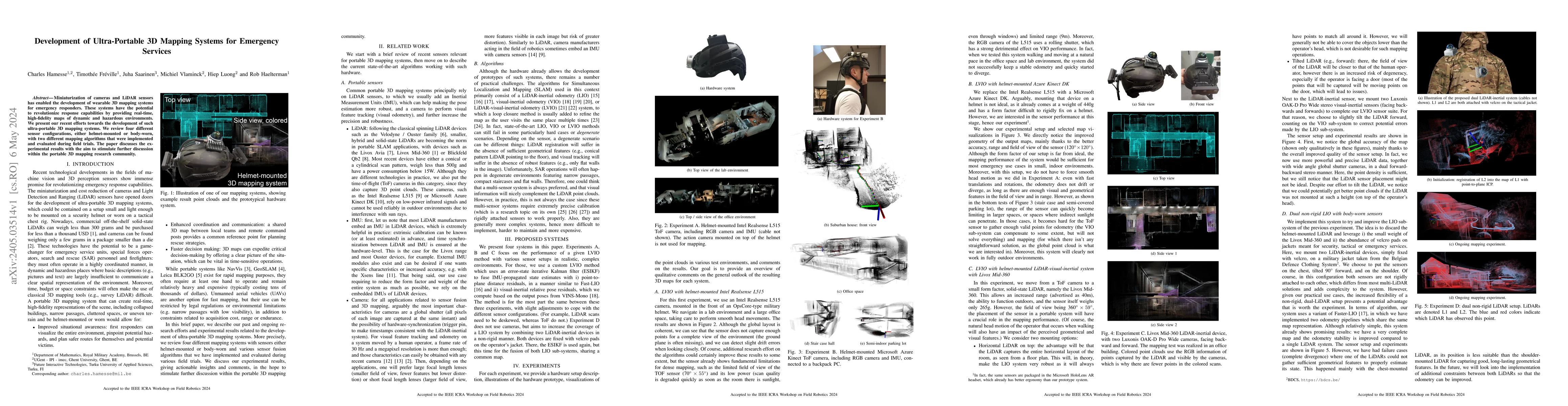
Miniaturization of cameras and LiDAR sensors has enabled the development of wearable 3D mapping systems for emergency responders. These systems have the potential to revolutionize response capabilities by providing real-time, high-fidelity maps of dynamic and hazardous environments. We present our recent efforts towards the development of such ultra-portable 3D mapping systems. We review four different sensor configurations, either helmet-mounted or body-worn, with two different mapping algorithms that were implemented and evaluated during field trials. The paper discusses the experimental results with the aim to stimulate further discussion within the portable 3D mapping research community.
Key Findings, in focus
Seven facets of this paper, analysed and brought into focus by AI.
This research explores the potential of wearable 3D mapping systems for first responders, which could revolutionize emergency response capabilities by providing real-time, high-fidelity maps of dynamic and hazardous environments.
- Four system configurations were developed and tested in realistic, complex environments.
- A custom LVIO method using an error-state iterative Kalman filter (ESIKF) showed promising results in fusing IMU-propagated state estimates with point-to-plane distance residuals and visual-inertial relative pose residuals.
- Experiments with a Microsoft Azure Kinect DK demonstrated improved mapping performance in small indoor environments, but range limitations were observed in larger spaces or areas with indirect sunlight.
- A helmet-mounted Livox Mid-360 LiDAR-visual-inertial system provided global accuracy in mapping, but sensor placement impacted the quality of point clouds.
- A dual non-rigid LIO system with body-worn sensors showed potential for improved odometry stability, though failure cases occurred when one LiDAR couldn't gather sufficient geometrical features.
This research explores the potential of wearable 3D mapping systems for first responders, which could revolutionize emergency response capabilities by providing real-time, high-fidelity maps of dynamic and hazardous environments.
The paper proposes and evaluates four ultra-portable 3D mapping systems using various sensor configurations and mapping algorithms, demonstrating their performance in complex environments.
The research focuses on wearable, ultra-portable 3D mapping systems for emergency services, presenting custom LVIO methods and novel sensor configurations not extensively explored in previous studies.
- Sensor limitations such as range, field of view, and power consumption can impact mapping performance.
- Multi-sensor systems require precise calibration, which is a research topic on its own.
- The non-rigid dual LiDAR setup, while flexible, adds complexity to the system.
- Refine sensor placement and explore additional data fusion techniques to create more robust and informative 3D maps for real-world scenarios.
- Address limitations of current sensors, like range and outdoor functionality, to enhance system performance.
Impact
Paper Details
Authors
PDF Preview
Key Terms
Citation Network
Current paper (gray), citations (green), references (blue)
Display is limited for performance on very large graphs.
Discussion 0