Publication
Metrics
AI Quick Summary
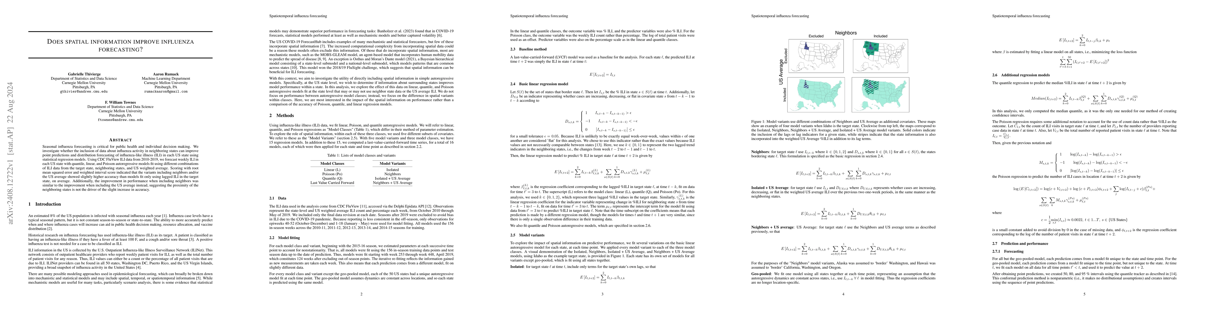
This study explores if incorporating spatial data from neighboring states enhances the forecasting of influenza-like illness (ILI) in the US using statistical regression models. Results suggest that models including data from neighboring states or the US average slightly improve forecast accuracy compared to those using only the target state's data.
Paper Preview
Abstract
Seasonal influenza forecasting is critical for public health and individual decision making. We investigate whether the inclusion of data about influenza activity in neighboring states can improve point predictions and distribution forecasting of influenza-like illness (ILI) in each US state using statistical regression models. Using CDC FluView ILI data from 2010-2019, we forecast weekly ILI in each US state with quantile, linear, and Poisson autoregressive models fit using different combinations of ILI data from the target state, neighboring states, and US weighted average. Scoring with root mean squared error and weighted interval score indicated that the variants including neighbors and/or the US average showed slightly higher accuracy than models fit only using lagged ILI in the target state, on average. Additionally, the improvement in performance when including neighbors was similar to the improvement when including the US average instead, suggesting the proximity of the neighboring states is not the driver of the slight increase in accuracy.
AI Key Findings
Get AI-generated insights about this paper's methodology, results, significance, and more — seven facets brought into focus.
Impact
Authors
PDF Preview
Citation Network
Current paper (gray), citations (green), references (blue)
Display is limited for performance on very large graphs.
Discussion 0