Downlink Analysis in Unmanned Aerial Vehicle (UAV) Assisted Cellular Networks with Clustered Users
Publication
Metrics
AI Quick Summary
This paper develops an analytical framework to evaluate the signal-to-interference-plus-noise ratio (SINR) coverage probability in UAV-assisted cellular networks with clustered users. It models UAVs and ground base stations as Poisson point processes and users as Poisson cluster processes, deriving SINR and area spectral efficiency metrics, and demonstrating that UAV height and clustering affect coverage performance.
Paper Preview
Abstract
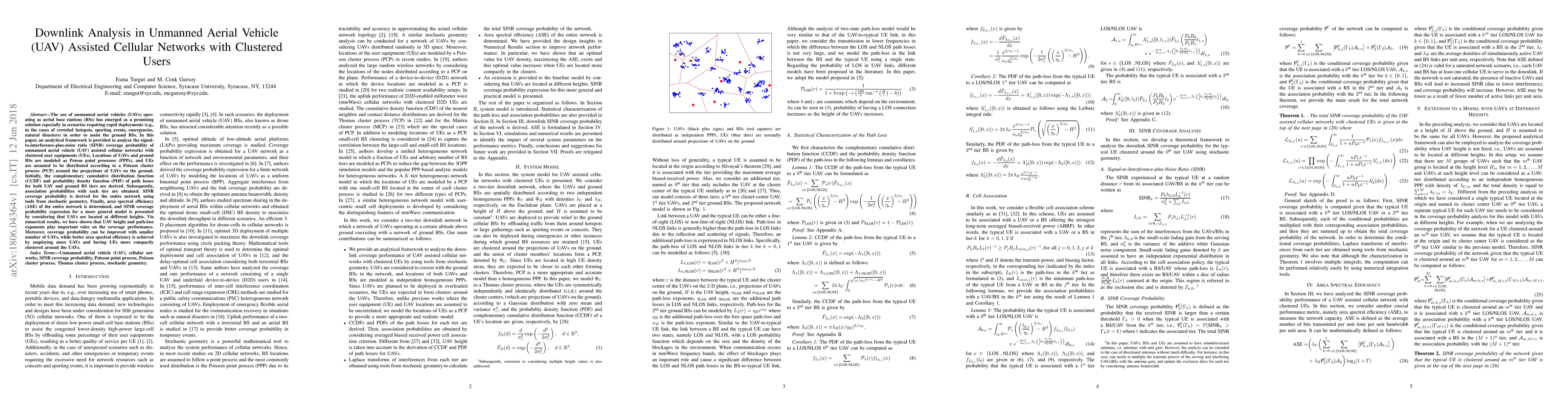
The use of unmanned aerial vehicles (UAVs) operating as aerial base stations (BSs) has emerged as a promising solution especially in scenarios requiring rapid deployments (e.g., in the cases of crowded hotspots, sporting events, emergencies, natural disasters) in order to assist the ground BSs. In this paper, an analytical framework is provided to analyze the signal-to-interference-plus-noise ratio (SINR) coverage probability of unmanned aerial vehicle (UAV) assisted cellular networks with clustered user equipments (UEs). Locations of UAVs and ground BSs are modeled as Poison point processes (PPPs), and UEs are assumed to be distributed according to a Poisson cluster process (PCP) around the projections of UAVs on the ground. Initially, the complementary cumulative distribution function (CCDF) and probability density function (PDF) of path losses for both UAV and ground BS tiers are derived. Subsequently, association probabilities with each tier are obtained. SINR coverage probability is derived for the entire network using tools from stochastic geometry. Finally, area spectral efficiency (ASE) of the entire network is determined, and SINR coverage probability expression for a more general model is presented by considering that UAVs are located at different heights. Via numerical results, we have shown that UAV height and path-loss exponents play important roles on the coverage performance. Moreover, coverage probability can be improved with smaller number of UAVs, while better area spectral efficiency is achieved by employing more UAVs and having UEs more compactly clustered around the UAVs.
AI Key Findings
Get AI-generated insights about this paper's methodology, results, significance, and more — seven facets brought into focus.
Impact
Paper Details
PDF Preview
Key Terms
Citation Network
Current paper (gray), citations (green), references (blue)
Display is limited for performance on very large graphs.
Discussion 0