Publication
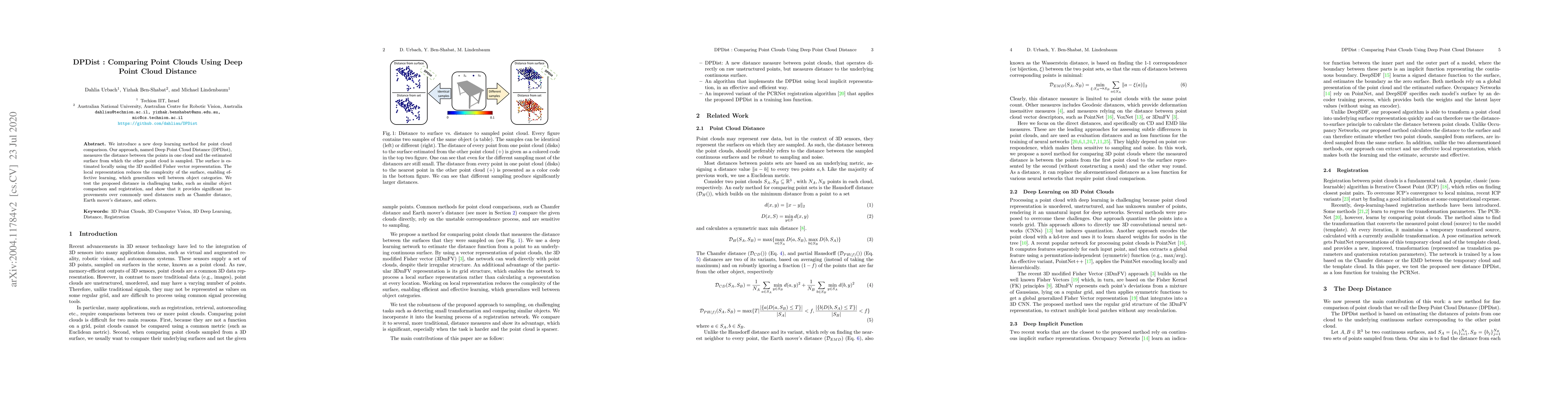
Metrics
AI Quick Summary
DPDist introduces a novel deep learning method for comparing point clouds by measuring the distance between points in one cloud and the locally estimated surface of the other. This approach leverages a 3D modified Fisher vector representation for efficient surface estimation, demonstrating significant improvements over traditional distances in tasks like object comparison and registration.
Paper Preview
Abstract
We introduce a new deep learning method for point cloud comparison. Our approach, named Deep Point Cloud Distance (DPDist), measures the distance between the points in one cloud and the estimated surface from which the other point cloud is sampled. The surface is estimated locally and efficiently using the 3D modified Fisher vector representation. The local representation reduces the complexity of the surface, enabling efficient and effective learning, which generalizes well between object categories. We test the proposed distance in challenging tasks, such as similar object comparison and registration, and show that it provides significant improvements over commonly used distances such as Chamfer distance, Earth mover's distance, and others.
AI Key Findings
Get AI-generated insights about this paper's methodology, results, significance, and more — seven facets brought into focus.
Impact
Paper Details
Authors
PDF Preview
Key Terms
Citation Network
Current paper (gray), citations (green), references (blue)
Display is limited for performance on very large graphs.
Discussion 0