DublinCity: Annotated LiDAR Point Cloud and its Applications
Publication
Metrics
AI Quick Summary
A new dataset of 260 million laser scanning points is introduced for city-scale scene understanding, providing a precise and densely labelled benchmark for training Convolutional Neural Networks to classify urban elements.
Paper Preview
Abstract
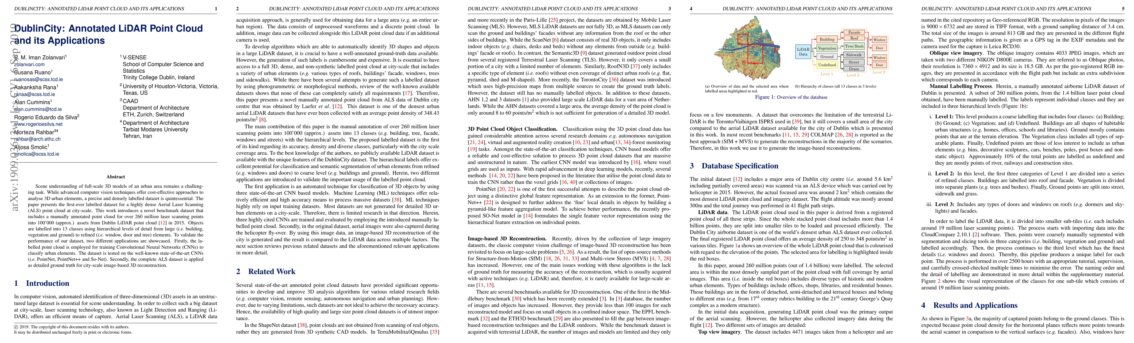
Scene understanding of full-scale 3D models of an urban area remains a challenging task. While advanced computer vision techniques offer cost-effective approaches to analyse 3D urban elements, a precise and densely labelled dataset is quintessential. The paper presents the first-ever labelled dataset for a highly dense Aerial Laser Scanning (ALS) point cloud at city-scale. This work introduces a novel benchmark dataset that includes a manually annotated point cloud for over 260 million laser scanning points into 100'000 (approx.) assets from Dublin LiDAR point cloud [12] in 2015. Objects are labelled into 13 classes using hierarchical levels of detail from large (i.e., building, vegetation and ground) to refined (i.e., window, door and tree) elements. To validate the performance of our dataset, two different applications are showcased. Firstly, the labelled point cloud is employed for training Convolutional Neural Networks (CNNs) to classify urban elements. The dataset is tested on the well-known state-of-the-art CNNs (i.e., PointNet, PointNet++ and So-Net). Secondly, the complete ALS dataset is applied as detailed ground truth for city-scale image-based 3D reconstruction.
AI Key Findings
Get AI-generated insights about this paper's methodology, results, significance, and more — seven facets brought into focus.
Impact
Paper Details
Authors
PDF Preview
Key Terms
Citation Network
Current paper (gray), citations (green), references (blue)
Display is limited for performance on very large graphs.
Discussion 0