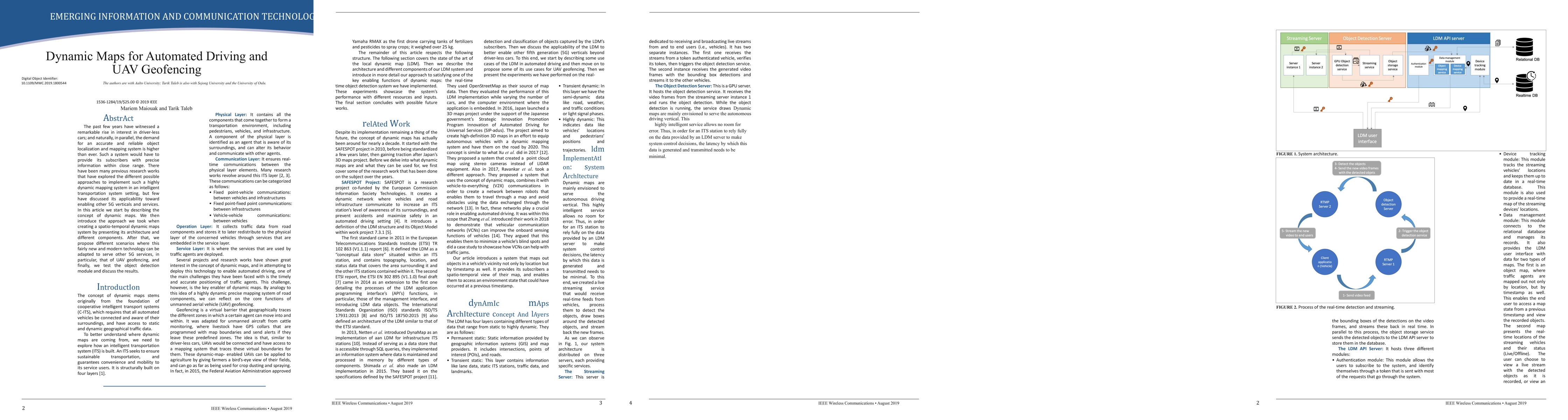
Dynamic maps for automated driving and UAVs geofencing
Publication
Metrics
Paper Preview
Abstract
The past few years have witnessed a remarkable rise in interest in driver-less cars; and naturally, in parallel, the demand for an accurate and reliable object localization and mapping system is higher than ever. Such a system would have to provide its subscribers with precise information within close range. There have been many previous research works that have explored the different possible approaches to implement such a highly dynamic mapping system in an intelligent transportation system setting, but few have discussed its applicability toward enabling other 5G verticals and services. In this article we start by describing the concept of dynamic maps. We then introduce the approach we took when creating a spatio-temporal dynamic maps system by presenting its architecture and different components. After that, we propose different scenarios where this fairly new and modern technology can be adapted to serve other 5G services, in particular, that of UAV geofencing, and finally, we test the object detection module and discuss the results.
AI Key Findings
Get AI-generated insights about this paper's methodology, results, significance, and more — seven facets brought into focus.
Impact
Paper Details
Authors
PDF Preview
Key Terms
Citation Network
Current paper (gray), citations (green), references (blue)
Display is limited for performance on very large graphs.
Discussion 0