01
MethodologyHow they did it
The research utilized a combination of satellite imagery analysis, climate modeling, and urban heat island (UHI) mapping to assess climate adaptation strategies in three distinct regions: Roßtal, Rosstal, and Erlangen. Data was collected from RGB satellite images, IPCC climate projections, and local environmental reports.
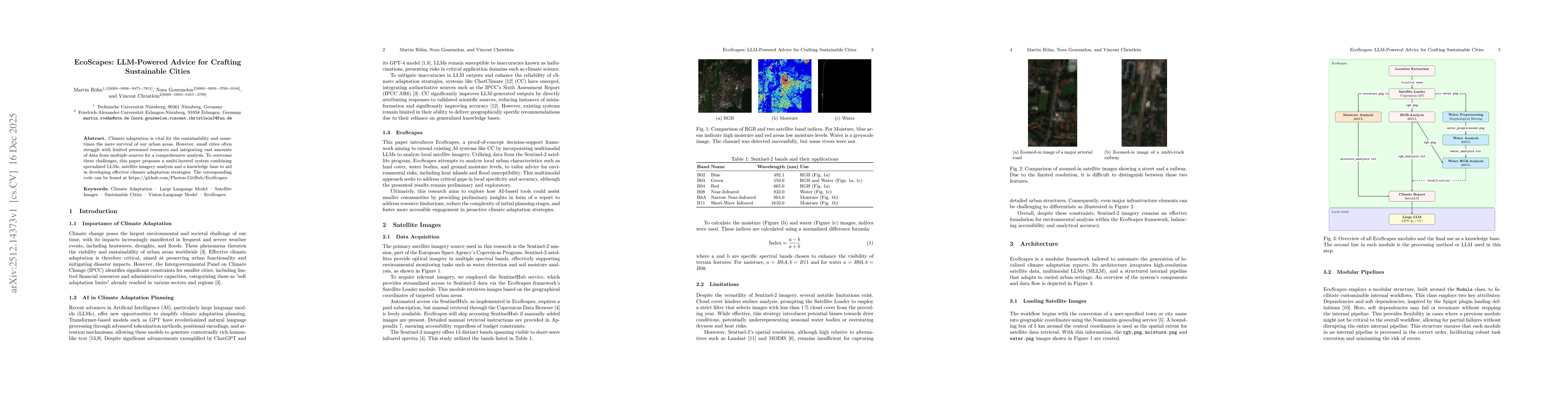
Discussion 0