01
MethodologyHow they did it
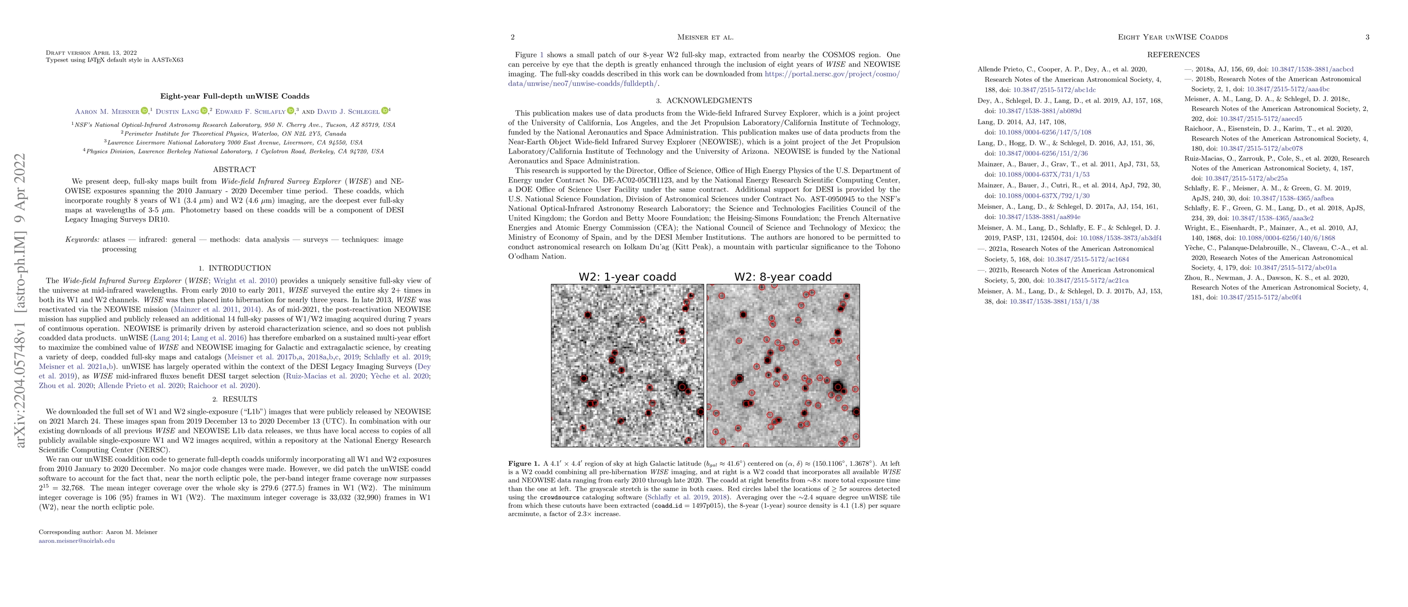
The research presents deep, full-sky maps built from WISE and NEOWISE exposures spanning 2010-2020, incorporating approximately 8 years of W1 (3.4 µm) and W2 (4.6 µm) imaging, resulting in the deepest ever full-sky maps at wavelengths of 3-5 µm.
Discussion 0