End-to-End Deep Structured Models for Drawing Crosswalks
Publication
Metrics
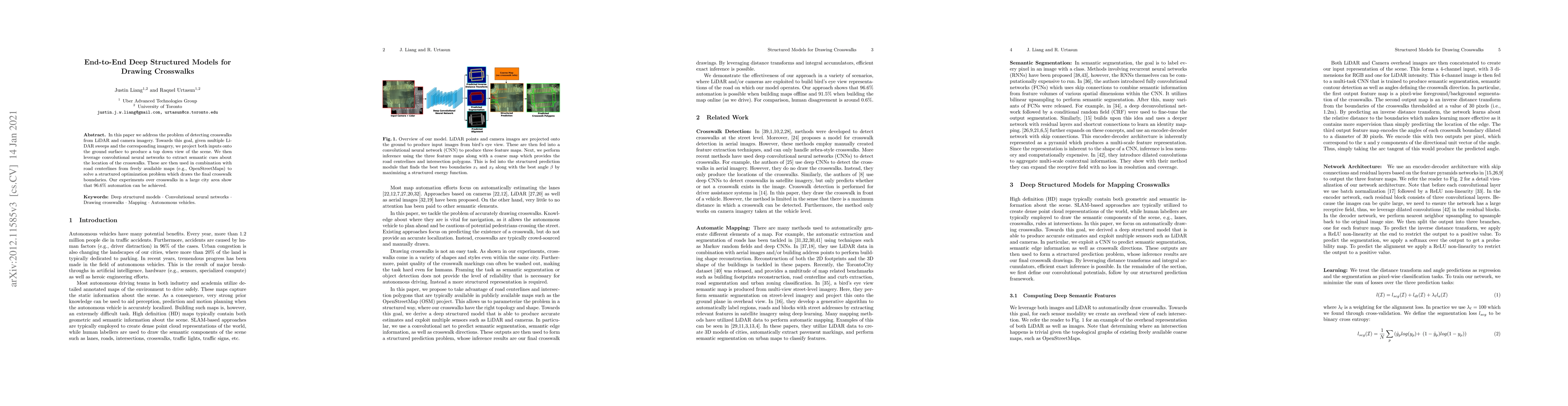
Paper Preview
Abstract
In this paper we address the problem of detecting crosswalks from LiDAR and camera imagery. Towards this goal, given multiple LiDAR sweeps and the corresponding imagery, we project both inputs onto the ground surface to produce a top down view of the scene. We then leverage convolutional neural networks to extract semantic cues about the location of the crosswalks. These are then used in combination with road centerlines from freely available maps (e.g., OpenStreetMaps) to solve a structured optimization problem which draws the final crosswalk boundaries. Our experiments over crosswalks in a large city area show that 96.6% automation can be achieved.
AI Key Findings
Get AI-generated insights about this paper's methodology, results, significance, and more — seven facets brought into focus.
Impact
Paper Details
Authors
PDF Preview
Key Terms
Citation Network
Current paper (gray), citations (green), references (blue)
Display is limited for performance on very large graphs.
Discussion 0