Engineering Adaptive Information Graphics for Disabled Communities: A Case Study with Public Space Indoor Maps
Publication
Metrics
AI Quick Summary
This research develops a framework for adaptive information graphics to enhance accessibility for people with disabilities, focusing on public space indoor maps. The study involved gathering requirements from experts and participants, developing a web tool, and evaluating it with users, showing positive feedback on usability and suitability.
Paper Preview
Abstract
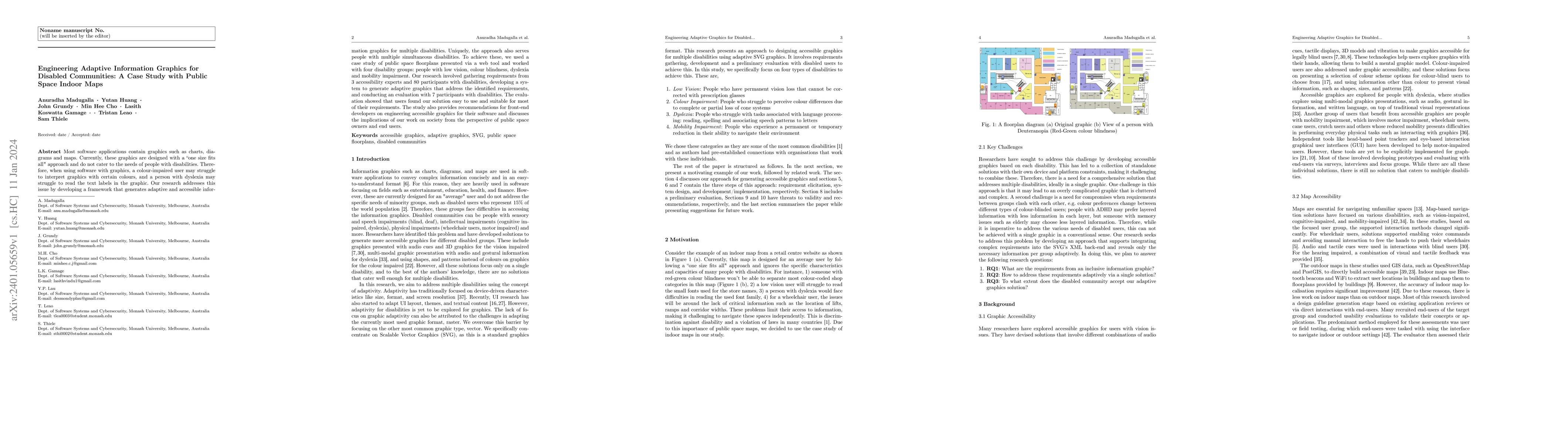
Most software applications contain graphics such as charts, diagrams and maps. Currently, these graphics are designed with a ``one size fits all" approach and do not cater to the needs of people with disabilities. Therefore, when using software with graphics, a colour-impaired user may struggle to interpret graphics with certain colours, and a person with dyslexia may struggle to read the text labels in the graphic. Our research addresses this issue by developing a framework that generates adaptive and accessible information graphics for multiple disabilities. Uniquely, the approach also serves people with multiple simultaneous disabilities. To achieve these, we used a case study of public space floorplans presented via a web tool and worked with four disability groups: people with low vision, colour blindness, dyslexia and mobility impairment. Our research involved gathering requirements from 3 accessibility experts and 80 participants with disabilities, developing a system to generate adaptive graphics that address the identified requirements, and conducting an evaluation with 7 participants with disabilities. The evaluation showed that users found our solution easy to use and suitable for most of their requirements. The study also provides recommendations for front-end developers on engineering accessible graphics for their software and discusses the implications of our work on society from the perspective of public space owners and end users.
AI Key Findings
Get AI-generated insights about this paper's methodology, results, significance, and more — seven facets brought into focus.
Impact
Paper Details
Authors
PDF Preview
Key Terms
Related Papers
No references found for this paper.
Discussion 0