01
MethodologyHow they did it
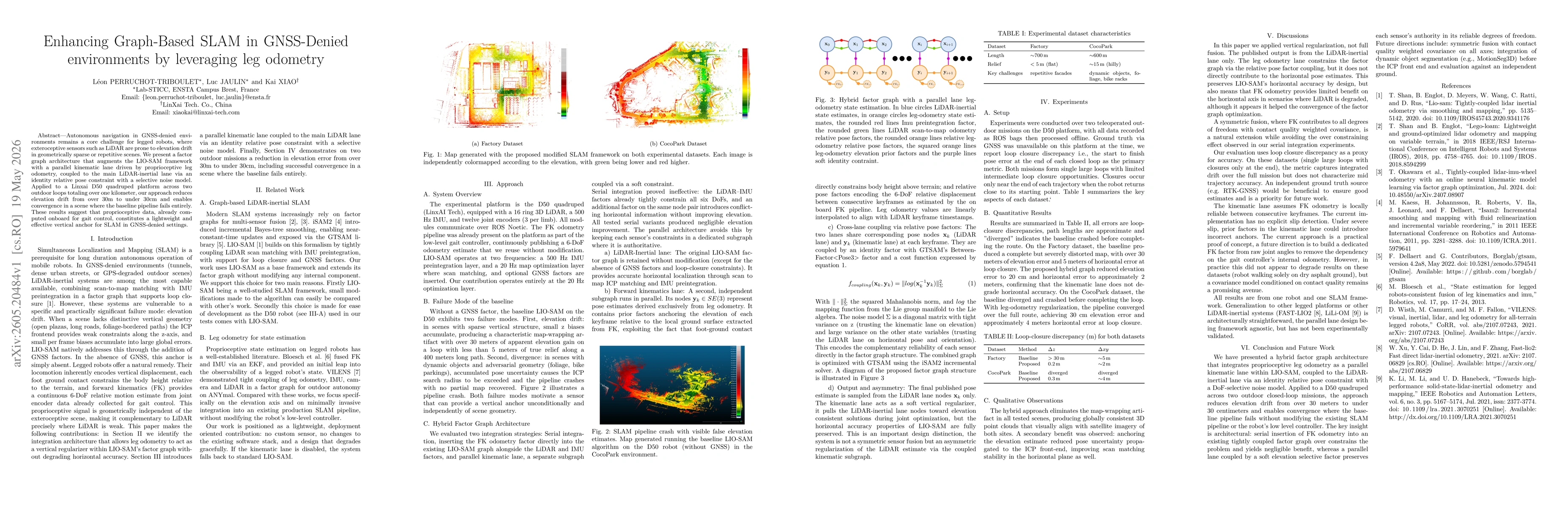
The approach builds a parallel kinematic lane driven by leg odometry attached to the LIO-SAM factor graph. It uses an identity relative pose constraint to couple the leg-odometry lane with the LiDAR-inertial lane, applying a selective noise model that trusts the leg odometry for elevation while preserving LiDAR-based horizontal accuracy. The system runs two subgraphs (LiDAR-inertial lane and leg-odometry lane) at separate frequencies with cross-lane Between factors, optimized jointly by GTSAM/iSAM2; the baseline LIO-SAM remains intact without GNSS factors, and the FK odometry is leveraged as a vertical regularizer rather than a full fusion component.
Discussion 0